-
 Martin Waldseemüller & Laurent Fries, West Africa, 1541£ 2,550.00
 -
Early woodcut map of West Africa and the Gulf of Guinea, 1556Giovanni Battista RamusioSeries: VeniceGiovanni Battista Ramusio, Early woodcut map of West Africa and the Gulf of Guinea, 1556£ 3,650.00
-
Petrus Bertius, Miniature map of the west coast of Africa, 1616£ 345.00
-
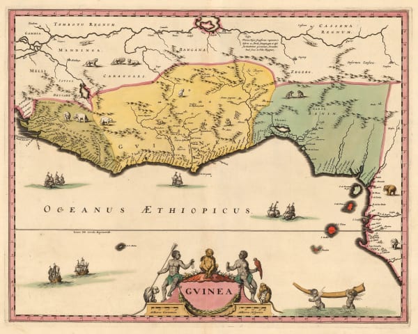
Petrus Bertius, Guinea, 1616£ 245.00
-
Mercator Hondius, West Africa & the Gulf of Guinea, 1623£ 1,550.00
-
Samuel Purchas, West Africa, São Tomé & the Gulf of Guinea, 1625£ 295.00
-
Robert Dudley, West Africa & the Gulf of Guinea, 1661£ 2,250.00
-
Olfert Dapper, West Africa & the Gulf of Guinea, 1676£ 485.00
-
Robert Morden, North & West Africa, 1688£ 125.00
-
Johannes van Keulen, Rare early chart of Gambia and Senegal coast, 1690 c.£ 465.00
-
Pierre Duval, West Africa & the Gulf of Guinea, 1694£ 145.00
-
Pierre Duval, Ethiopia & Sudan, 1694£ 225.00
-
Vincenzo Coronelli, West Africa & the Gulf of Guinea, 1696£ 765.00
-
Nicolas Sanson, West and Northwest Africa, 1700£ 475.00
-
Pierre Mortier, Sea Chart of West Africa from Ghana to Angola, 1700£ 1,450.00
-
Pierre Mortier, Chart of West Africa from Guinea to Ghana, 1700£ 1,450.00
-
Guillaume De L'Isle, North & West Africa, 1707£ 445.00
-
Pierre Mortier, Sea Chart of West Africa & Atlantic Islands, 1708£ 1,350.00
-
Valk & Schenk, West Africa & the Gulf of Guinea, 1720 c.£ 645.00
-
Guillaume De L'Isle, De L'Isle's famous map of Senegal, 1727£ 475.00
-
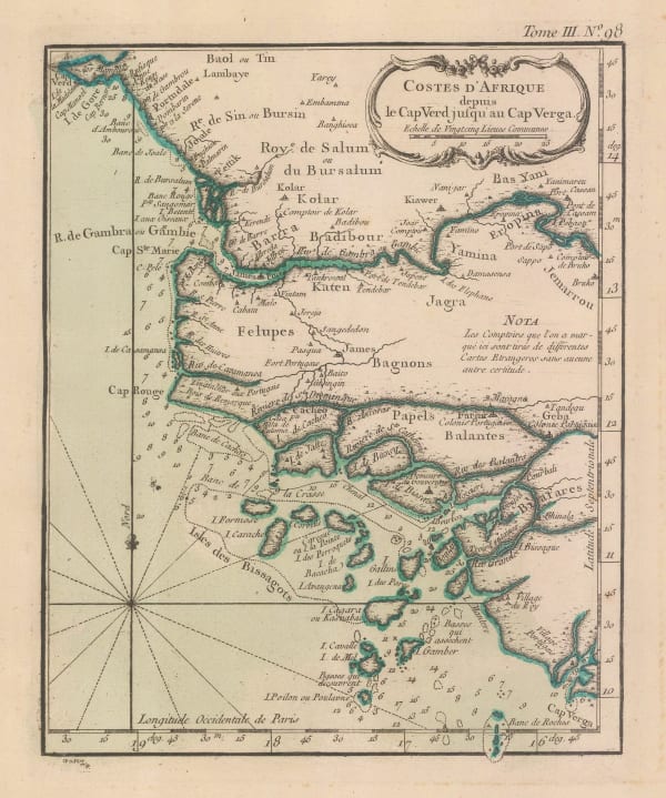
Jacques-Nicolas Bellin, Chart of Guinea, Sierra Leone and Liberia coast, 1746£ 92.00
-
Jacques-Nicolas Bellin, Chart of Cote d'Ivoire coast, 1746£ 82.00
-
Jacques-Nicolas Bellin, Chart of Ghana coast, 1750 c.£ 145.00
-
Herman Moll, West Africa, 1755 c.Reserved
-
Bowen & Gibson, Miniature map of West Africa, 1758£ 140.00
-
Jacob van der Schley, Senegal, Mauritania, and Mali, 1760 c.£ 295.00
-
Andrew Dury, Map of Senegal, with Part of the Coast of Africa, 1761£ 118.00
-
Jacques-Nicolas Bellin, Mouth of the River Senegal, 1764£ 68.00
-
Jacques-Nicolas Bellin, Arguin Island, Mauritania, 1764£ 85.00
-
Jacques-Nicolas Bellin, Gambia, Senegal & Guinea-Bissau, 1764£ 125.00
-
Jacques-Nicolas Bellin, Senegal & Mauritania, 1764£ 125.00
-
Jacques-Nicolas Bellin, Liberia, 1764£ 95.00
-
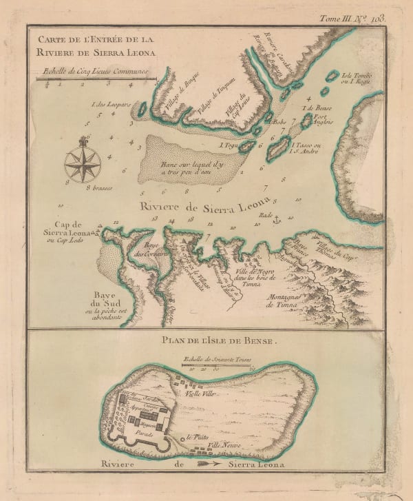
Jacques-Nicolas Bellin, Sierra Leone, 1764£ 125.00
-
Jacques-Nicolas Bellin, Chart of the Cape Verde Islands and the coast of Africa , 1765£ 225.00
-
Emanuel Bowen, West Africa, 1766£ 645.00
-
Malachy Postlethwayt, West Africa with a list of European Settlements, 1766£ 1,450.00
-
Thomas Jefferys, Western Africa from Cape Blanco to Cape Virga, 1768£ 1,250.00
-
Rigobert Bonne, Northwest Africa coast, Tangier to Sierra Leone, 1780 c.£ 90.00
-
Antonio Zatta, West Africa from Senegal to Ghana, 1784£ 175.00
-
John Pinkerton, Western Africa, 1813£ 475.00
-
Maj. Dixon Denham, Sketch map of Lake Chad, 1826£ 145.00
-
James Wyld, Sierra Leone, 1840 c.£ 1,250.00
-
Royal Geographical Society (RGS), West Coast of Africa, 1840 c.£ 125.00
-
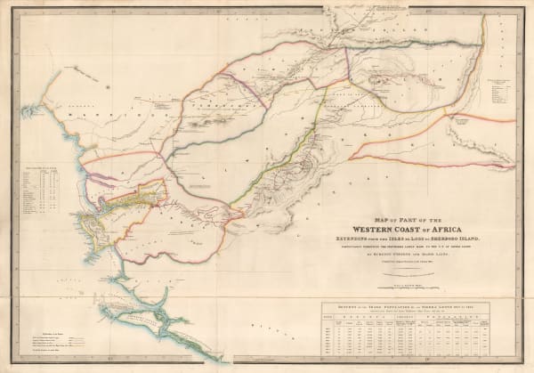
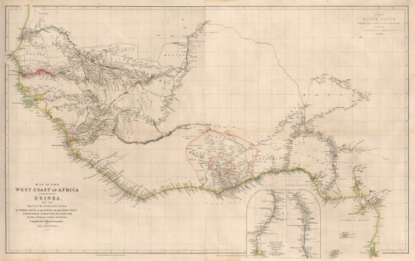
John Arrowsmith, Map of the West Coast of Africa, 1841£ 1,450.00
-
Royal Geographical Society (RGS), The Cross River, Nigeria, 1844£ 48.00
-
Joseph Meyer, West African coast, 1844£ 145.00
-
Samuel Augustus Mitchell, Map of Africa, 1847£ 165.00
-
John Tallis, Western Africa, 1851£ 345.00
-
Royal Geographical Society (RGS), The Rivers Kwora & Chadda or Binue, 1855£ 115.00
-
Joseph Meyer, Nigeria, Cameroon & Chad, 1855 c.£ 165.00
-
Justus Perthes, Sketch map of northern Senegal, 1858£ 68.00
-
Royal Geographical Society (RGS), Western Africa - To Illustrate Travels in the Yoruba and Nupe Countries, 1859£ 145.00
-
Archibald Fullarton, Ethiopia & Central Africa, 1860 c.£ 195.00
-
Justus Perthes, German Exploration in Gabon, 1872£ 88.00
-
Society for the Diffusion of Useful Knowledge (SDUK), West Africa I, 1875£ 175.00
-
A. Simon, Dakar, Senegal, 1876£ 195.00
-
Royal Geographical Society (RGS), Lake Chad and Neighbouring Regions, 1876£ 68.00
-
Society for the Diffusion of Useful Knowledge (SDUK), West Africa II, 1879£ 95.00
-
Archibald Fullarton, Nigeria, Cameroon & Chad, 1880 c.£ 30.00
-
Justus Perthes, Sierra Leone, 1883£ 175.00
-
Justus Perthes, Cameroon, 1885£ 72.00
-
Royal Geographical Society (RGS), Migrations of Bantu Speakers in Nigeria & Cameroon, 1888£ 185.00
-
Royal Geographical Society (RGS), Nigeria & Benin - Yoruba Country, 1891£ 265.00
-
Royal Geographical Society (RGS), Sierra Leone, 1892£ 165.00
-
F.A. Brockhaus, German Colonies in Africa - Cameroon, Togo & Namibia, 1893£ 68.00
-
Royal Geographical Society (RGS), Map showing Mr Alldridge's Routes in the Hinterland of Sierra Leone, 1894£ 98.00
-
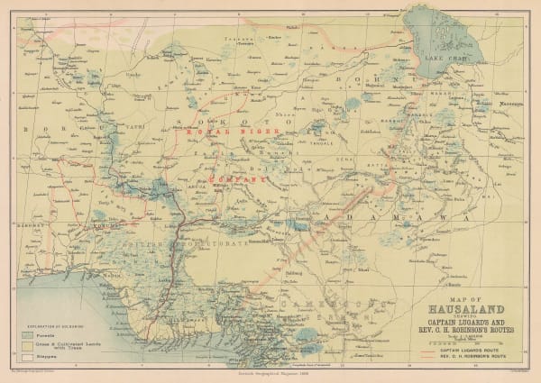
Scottish Geographical Society (SGS), Hausaland, Nigeria, 1896£ 345.00
-
Royal Geographical Society (RGS), Map of the Niger Delta, 1897£ 645.00
-
Royal Geographical Society (RGS), Sketch Map of the Republic of Liberia, 1905£ 245.00
-
Edward Hertslet, Resolving Cameroon's Eastern Border, 1909£ 145.00
-
Edward Hertslet, Cameroon - Equatorial Guinea Border Commission, 1909£ 44.00
-
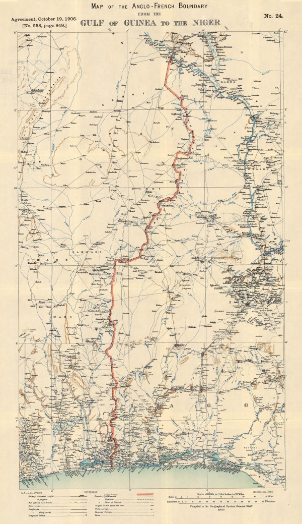
Edward Hertslet, Map of the Anglo-French Boundary from the Gulf of Guinea to the Niger, 1909£ 175.00
-
Edward Hertslet, Map of the Anglo-French Boundary from the Gulf of Guinea to the Niger (Southern Portion), 1909£ 125.00
-
Edward Hertslet, Map of the Frontier between Gold Coast and Togoland by the Boundary Commission, 1909£ 145.00
-
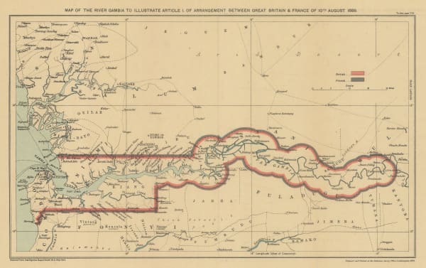
Edward Hertslet, Map of the River Gambia to Illustrate Article 1. of Arrangement Between Great Britain & France, 1909£ 44.00
-
Edward Hertslet, Map of the Sierra Leone-Liberia Boundary, 1909£ 115.00
-
Edward Hertslet, Resolving Cameroon's Borders, 1909£ 58.00
-
Edward Hertslet, Nigeria - Cameroon Boundary Commission, 1909£ 115.00
-
Edward Hertslet, Nigeria - Cameroon Boundary Commission, 1909£ 40.00
-
Edward Hertslet, Sierra Leone - Liberia Boundary, 1909£ 85.00


Page
1
of 2