-
 Royal Geographical Society (RGS), Chart of the Currents Off the Cape of Good Hope, 1865£ 345.00
 -
Royal Geographical Society (RGS), Map of the Principle Part of Damara Land, 1866£ 245.00
-
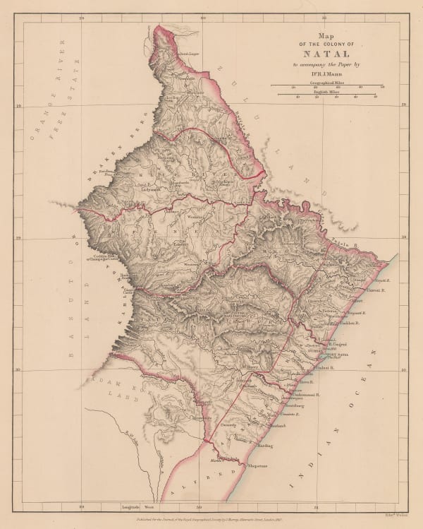
Royal Geographical Society (RGS), Map of the Colony of Natal, 1867£ 85.00
-
James Imray, The Coast of the Cape Colony, 1868£ 2,250.00
-
Justus Perthes, Missionary Map of South Africa, 1869£ 75.00
-
Justus Perthes, Exploration of Zambia, Malawi & Tanzania, 1870£ 78.00
-
Justus Perthes, Originalkarte von C.Mauch's Reisen im Innern von Sud-Afrika, 1870£ 345.00
-
Royal Geographical Society (RGS), Sketch Map of Mr. Baines' Routes Between the Limpopo and Zambesi Rivers, 1871£ 150.00
-
Royal Geographical Society (RGS), Map of Route from The Tati Settlement to Delagoa Bay, 1872£ 145.00
-
Royal Geographical Society (RGS), A Sketch map of Part of South Eastern Africa to Illustrate the Journeys of Dr Lacerda (1798) the Pombeiros (1806-11) and Major Monteiro (1831-32), 1873£ 395.00
-
Royal Geographical Society (RGS), Map to illustrate Explorations in South Africa from Walvische Bay to Lake Ngami by C Andersson., 1874£ 275.00
-
Royal Geographical Society (RGS), Route Map of the Gasa Country, 1875£ 175.00
-
Society for the Diffusion of Useful Knowledge (SDUK), South Africa, 1875£ 345.00
-
Royal Geographical Society (RGS), South East Madagascar and the Ibara Country, 1875£ 195.00
-
Royal Geographical Society (RGS), The Central Provinces of Madagascar, 1875£ 345.00
-
Royal Geographical Society (RGS), Map of the Transvaal and the Surrounding Territories, 1877£ 495.00
-
Royal Geographical Society (RGS), Part of Madagascar from the Latest Surveys, 1877£ 195.00
-
Royal Geographical Society (RGS), West Central Madagascar, 1877£ 195.00
-
Royal Geographical Society (RGS), Physical Map of Madagascar, 1878£ 68.00
-
F.A. Brockhaus, Stanley's discoveries in the Congo River Basin, 1878 c.£ 1,250.00
-
-
Royal Geographical Society (RGS), Map of the Central Portion of South Africa Illustrating Dr. Holub's Journeys 1873-9, 1880£ 165.00
-
Frederick Dangerfield & Co., Natal, 1880 c.£ 575.00
-
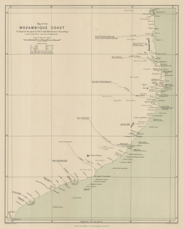
Royal Geographical Society (RGS), Map of the Mozambique Coast, 1882£ 195.00
-
Royal Geographical Society (RGS), The Interior of South Africa, 1884£ 795.00
-
Royal Geographical Society (RGS), East Africa between the Zambesi and Rovuma Rivers, 1885£ 495.00
-
Justus Perthes, Eastern Cape Province and Lesotho, 1885£ 285.00
-
G. & J. Bartholomew, Central Africa, 1887£ 42.00
-
Justus Perthes, Karte der Witwatersrand Goldfelder, 1888£ 58.00
-
Royal Geographical Society (RGS), Map of Mr. F.C. Selous' Routes in the Matabele and Mashuna Countries, 1888£ 195.00
-
Royal Geographical Society (RGS), The Kaap Goldfields, 1888£ 112.00
-
Royal Geographical Society (RGS), Livingstone's maps of Lake Bangweulu, Zimbabwe, 1889£ 145.00
-
Arbuckle Brothers Company, South Africa (Cape Colony), 1889£ 165.00
-
Royal Geographical Society (RGS), Eastern Africa between the Rovuma and Zambesi Rivers, 1890£ 495.00
-
Scottish Geographical Society (SGS), The Stevenson Road from Lake Malawi to Lake Tanganyika, 1890£ 275.00
-
Scottish Geographical Society (SGS), Stanley's Emin Pasha Expedition, 1890£ 775.00
-
Scottish Geographical Society (SGS), Political Sketch-Map of Central Africa, 1890£ 495.00
-
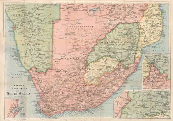
George W. Bacon, Bacon's Large-Print Map of South Africa, 1890 c.£ 775.00
-
Royal Geographical Society (RGS), A Map of Matabililand and Mashonaland Manica and Gazaland, 1891£ 395.00
-
Royal Geographical Society (RGS), Map of Gaza Land showing route taken by Mr.D. Doyle from Manica to the Mouth of the Limpopo, 1891£ 115.00
-
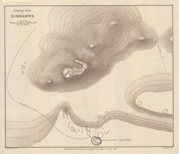
Royal Geographical Society (RGS), General Plan of Zimbabwe, 1892£ 175.00
-
Royal Geographical Society (RGS), Imerina (Central Madagascar), 1892£ 86.00
-
Scottish Geographical Society (SGS), Map of the Country between the Shire and Zambesi Rivers, 1892£ 80.00
-
Gustav Arthur Troye, Transvaal Gold Fields, 1892£ 800.00
-
F.A. Brockhaus, German Colonies in Africa - Cameroon, Togo & Namibia, 1893£ 68.00
-
Royal Geographical Society (RGS), Part of British Bechuanaland and The Kalahari Desert, 1893£ 88.00
-
Royal Geographical Society (RGS), Malawi and Zambia, 1893£ 145.00
-
Royal Geographical Society (RGS), Map of the Zoutpansberg Goldfields, 1893£ 375.00
-
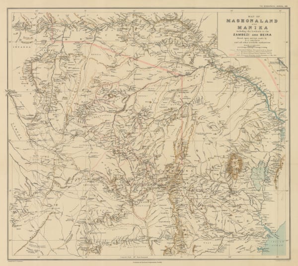
Royal Geographical Society (RGS), Map of Mashonaland and Manika, 1895£ 445.00
-
Royal Geographical Society (RGS), The Ong'ulahi River and Adjacent Country, 1895£ 125.00
-
Royal Geographical Society (RGS), Zambia & Victoria Falls, 1897£ 145.00
-
Royal Geographical Society (RGS), Malawi & Zambia, 1897£ 185.00
-
Scottish Geographical Society (SGS), Orographical map of Southern Rhodesia, 1897£ 375.00
-
Royal Geographical Society (RGS), Eastern Zambia, 1898£ 135.00
-
Edward Stanford, The Boer Republics, 1899£ 385.00
-
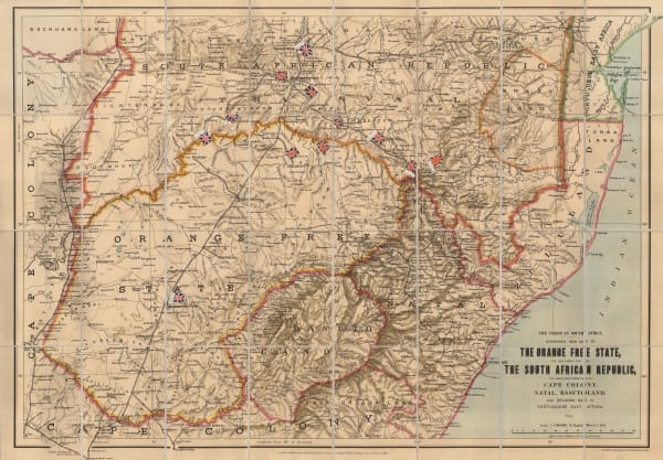
Edward Stanford, The Orange Free State and the Southern Part of The South African Republic, 1899£ 845.00
-
W. & A.K. Johnston, W & A.K. Johnstons Map to Illustrate the Transvaal Question, 1899£ 445.00
-
Scottish Geographical Society (SGS), A Map of Rhodesia, 1900£ 295.00
-
Scottish Geographical Society (SGS), Map Shewing The Gold Districts of Mashonaland & Matabeleland, 1900£ 395.00
-
F Bianconi, Nouvelle Carte Physique & Miniere du Transvaal, 1900£ 495.00
-
Wood & Ortlepp, "Briton or Boer" Special Map of the Boer Republics, 1900£ 850.00
-
The Times, The Times Map of British South Africa, the Transvaal and Orange Free State, 1900 c.£ 695.00
-
Royal Geographical Society (RGS), A Map of Marotseland, 1901£ 425.00
-
Dr. G.A.F Molengraff, Geological Sketchmap of the Transvaal, 1902£ 825.00
-
George Philip & Son Ltd., The Daily Mail Map of the Boer Republics, 1902 c.£ 445.00
-
Edward Weller, Map of the Orange River Colony, 1904£ 195.00
-
Scottish Geographical Society (SGS), Congo Free State, 1905£ 175.00
-
Scottish Geographical Society (SGS), Congo Free State, 1905£ 225.00
-
Weller & Grahams Ltd., Map of the Transvaal Colony, 1906£ 245.00
-
Royal Geographical Society (RGS), Map to Illustrate the Physical Features of the Transvaal, 1906£ 145.00
-
Royal Geographical Society (RGS), Eastern Zambia, 1907£ 175.00
-
Royal Geographical Society (RGS), Portuguese East Africa between the Zambezi and Pungwe Rivers, 1907£ 78.00
-
Edward Hertslet, Anglo-Portuguese Boundary in Manica and Adjoining Regions, 1909£ 82.00
-
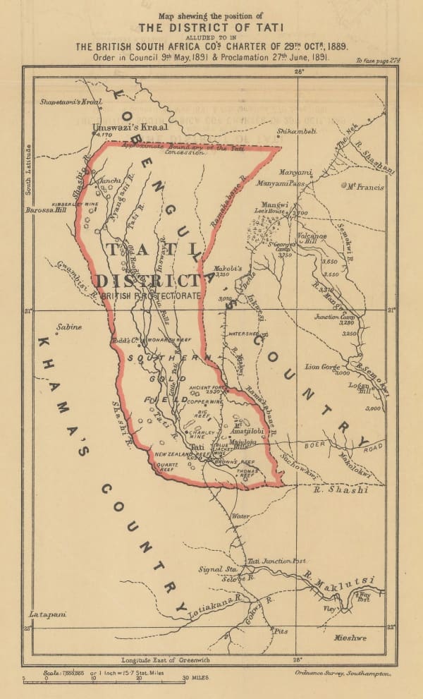
Edward Hertslet, Map Shewing the Position of The District of Tati, 1909£ 32.00
-
Royal Geographical Society (RGS), Zambia & the Congo, 1910£ 175.00
-
Royal Geographical Society (RGS), South Africa showing Railways, 1910£ 135.00
-
Royal Geographical Society (RGS), South West Africa, 1910£ 285.00
-
George Philip & Son Ltd., Cape Colony & The Diamond Fields, 1910 c.£ 125.00
-
G. & J. Bartholomew, Central and South Africa, 1910 c.£ 495.00
-
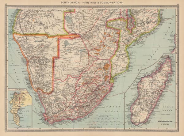
George Philip & Son Ltd., South Africa: Industries & Communications, 1910 c.£ 185.00


Page
2
of 3