-
 Aleph, Scotland, 1869£ 1,850.00
 -
Royal Geographical Society (RGS), The South-Polar Regions, 1869£ 950.00
-
Aleph, Wales, 1869£ 1,350.00
-
Gaylord Watson, Watson's New Map of the Western States Territories, Mexico, and Central America, 1869£ 4,500.00
-
Justus Perthes, Missionary Map of South Africa, 1869£ 75.00
-
Ordnance Survey, Knightsbridge, Kensington & Brompton, 1869£ 3,500.00
-
Justus Perthes, Overview Map of Alexander von Humboldt's Travels, 1869£ 225.00
-
Justus Perthes, Arctic Russia, Wrangel Island & the Bering Strait, 1869£ 125.00
-
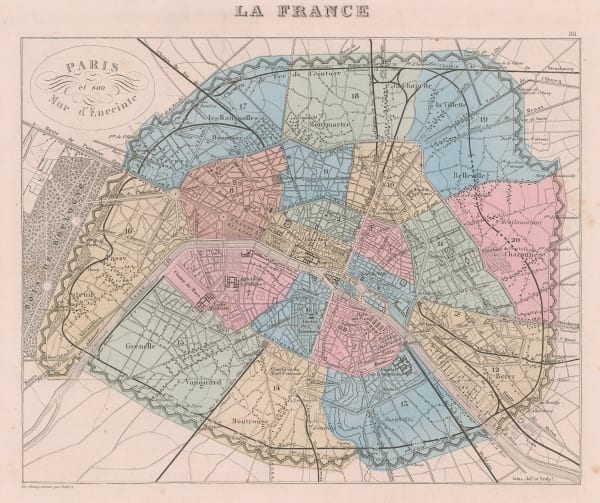
Alexandre Vuillemin, Paris showing the Thiers Wall, 1869£ 250.00
-
William Gifford Palgrave, Al-Hofuf, 1869£ 195.00
-
Justus Perthes, The Swiss Alps, 1869£ 195.00
-
James Wyld, Wyld's New Plan of London & Its Vicinity, 1869£ 2,950.00
-
Justus Perthes, Alaska, 1869£ 295.00
-
Bernhard Studer, Geological map of Switzerland, 1869 c.£ 1,650.00
-
Royal Geographical Society (RGS), Caravan routes in Kenya and Tanzania, 1870£ 725.00
-
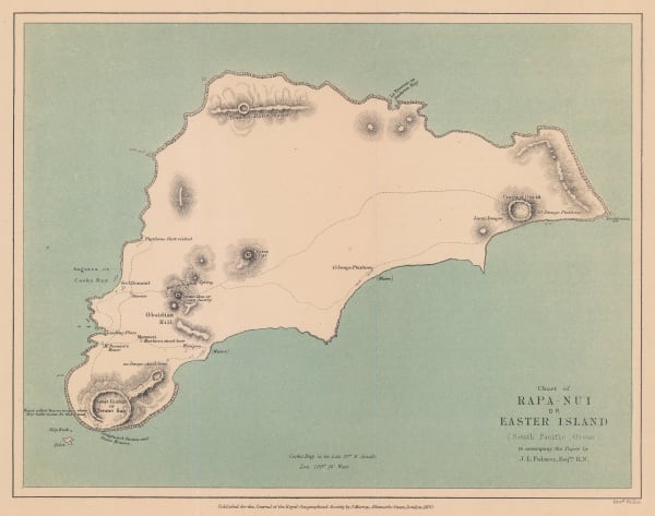
Royal Geographical Society (RGS), Chart of Rapa-Nui or Easter Island, 1870£ 275.00
-
Justus Perthes, Christian Mission in the Pacific Ocean, 1870£ 50.00
-
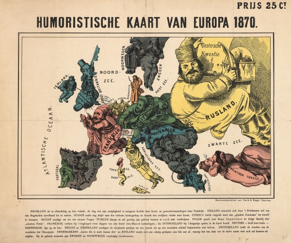
Arnold Neumann, Dutch edition of a rare German caricature map of Europe during the Franco-Prussian War, 1870£ 3,500.00
-
Royal Geographical Society (RGS), Map of the South-Western Portion of the United States, 1870£ 375.00
-
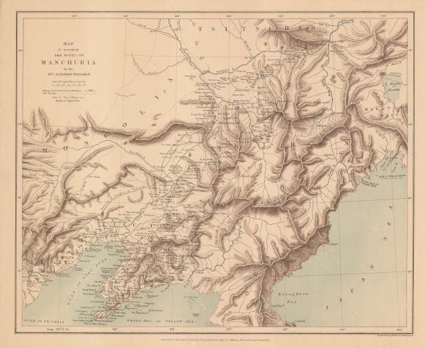
Royal Geographical Society (RGS), Map to Accompany the Notes on Manchuria, 1870£ 175.00
-
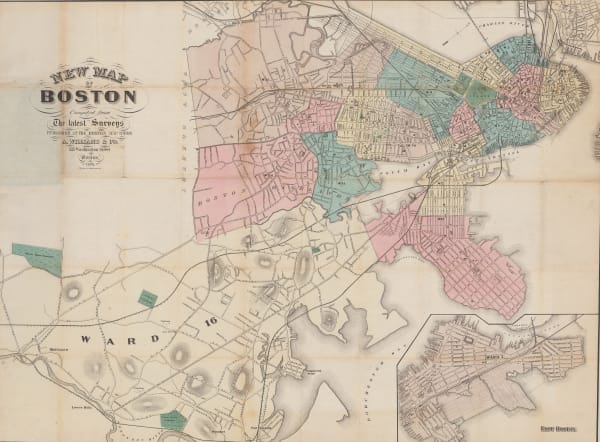
A. Williams & Co., New Map of Boston from the Latest Surveys, 1870£ 1,450.00
-
Justus Perthes, Exploration of Zambia, Malawi & Tanzania, 1870£ 78.00
-
Justus Perthes, Interior of South Africa, Botswana, and Zimbabwe, 1870£ 345.00
-
Justus Perthes, Russian Lapland, 1870£ 165.00
-
A. Simon, Plan of the docks of Seville, 1870£ 72.00
-
Royal Geographical Society (RGS), Sketch Map Showing the Mineral & Silk Districts of the Province of Shan-Tung (China), 1870£ 265.00
-
Royal Geographical Society (RGS), Surface Temperatures of the North Atlantic between Shetland & Greenland, 1870£ 155.00
-
Justus Perthes, South Australia between Lake Eyre and Lake Blanche, 1870£ 52.00
-
Ordnance Survey, Knightsbridge & Belgravia, 1870£ 1,850.00
-
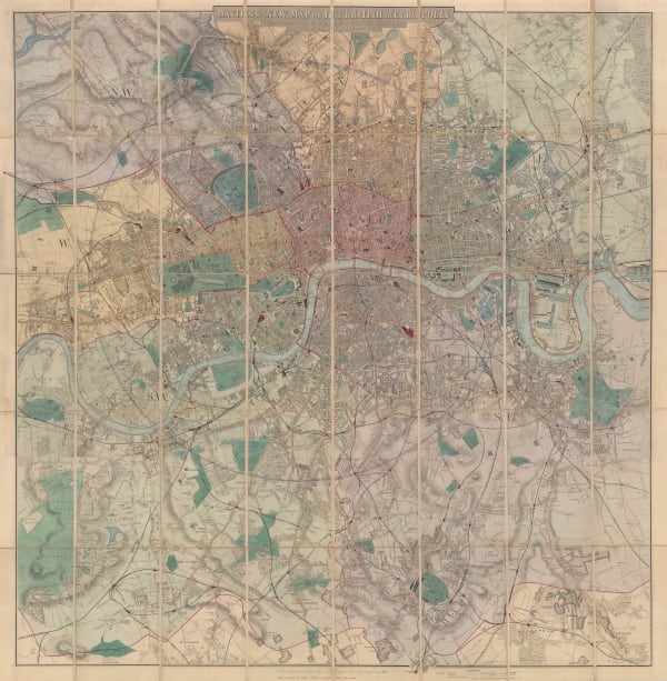
Benjamin Rees Davies, Davies's New Map of London, 1870£ 2,250.00
-
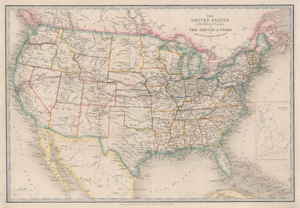
James Wyld, The United States, 1870 (c.)£ 1,250.00
-
G. & J. Bartholomew, Arabia, 1870 c£ 195.00
-
Alvin J. Johnson, Western States of the USA, 1870 c£ 645.00
-
W.H. Smith & Son, Environs of London, 1870 c£ 295.00
-
W.H. Smith & Son, New Plan of London, 1870 c£ 395.00
-
William Collins, New Zealand, 1870 c£ 115.00
-
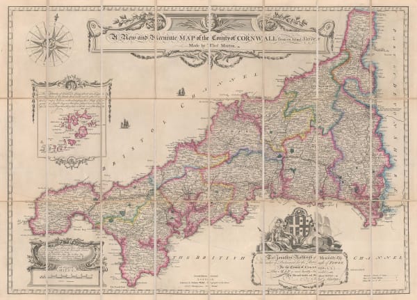
Thomas Martyn, A New and Accurate Map of the County of Cornwall, 1870 c.£ 1,550.00
-
G. Woldermann, Folding wall map of Africa, 1870 c.£ 1,450.00
-
Society for the Diffusion of Useful Knowledge (SDUK), Turkey (Anatolia) divided into provinces and Cyprus, 1870 c.£ 115.00
-
J. Goubaud, Austrian or Austro-Hungarian Empire, 1870 c.£ 55.00
-
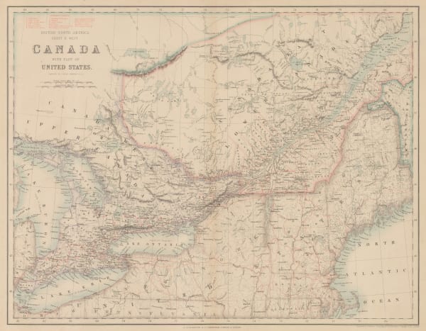
John Dower, Canada &c., 1870 c.£ 78.00
-
Archibald Fullarton, Canada with part of the United States, 1870 c.£ 125.00
-
Heinrich C. Kiepert, Die Vereinigten Staaten von Nord America nebst Canada, 1870 c.£ 445.00
-
Charton, Cameroon to South Sudan, 1870 c.£ 48.00
-
Geological Map of the Lead Region in the States of Wisconsin, Illinois and Iowa, 1870 c.J.D. WhitneyJ.D. Whitney, Geological Map of the Lead Region in the States of Wisconsin, Illinois and Iowa, 1870 c.£ 585.00
-
Ferdinand Hayden, Map of the Shoshone Geysers, 1870 c.£ 395.00
-
Julius Maier, Neueste Karte der Erde, 1870 c.£ 2,650.00
-
Justus Perthes, North America, 1870 c.£ 80.00
-
Archibald Fullarton, Oceania and Pacific Ocean, 1870 c.£ 115.00
-
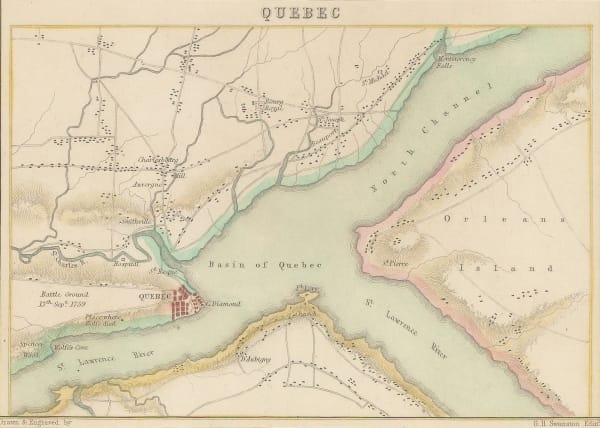
Archibald Fullarton, Quebec City and environs, 1870 c.£ 45.00
-
Justus Perthes, South America showing European possessions, 1870 c.£ 55.00
-
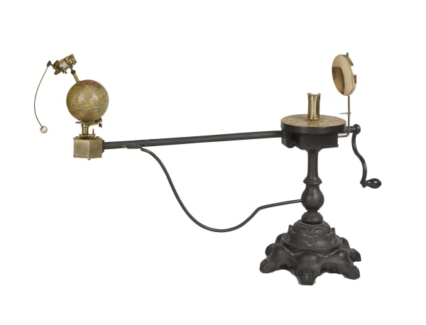
J. Berg, Tellurian, 1870 c.£ 5,250.00
-
Blackie & Son, Sumatra, Borneo, and the Philippines, 1870 c.£ 225.00
-
Royal Geographical Society (RGS), Milos, Anti-Milos, Kimolos & Poliegos, 1870 c.£ 125.00
-
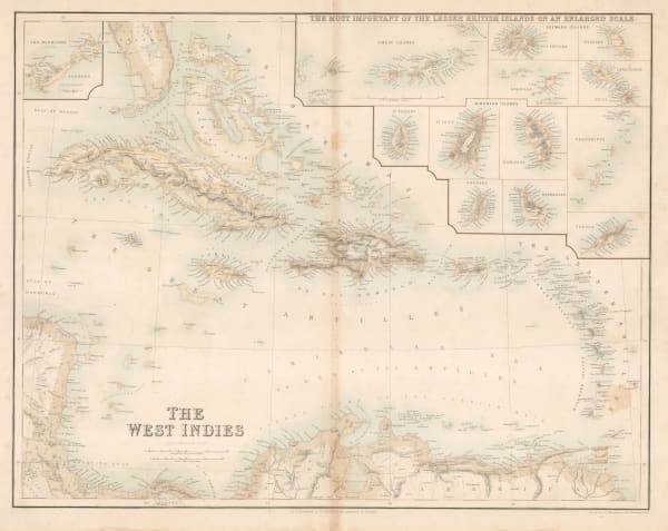
Archibald Fullarton, The West Indies, 1870 c.£ 250.00
-
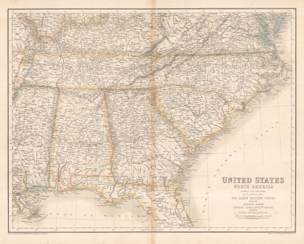
Archibald Fullarton, Southeast United States, 1870 c.£ 78.00
-
Archibald Fullarton, United States - The North Central Section, 1870 c.£ 75.00
-
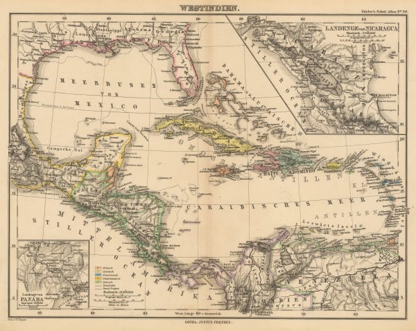
Justus Perthes, The West Indies and Central America, 1870 c.£ 85.00
-
James Wyld, Wyld's Military Staff Map of Central Asia and Afghanistan, 1870 c.£ 1,950.00
-
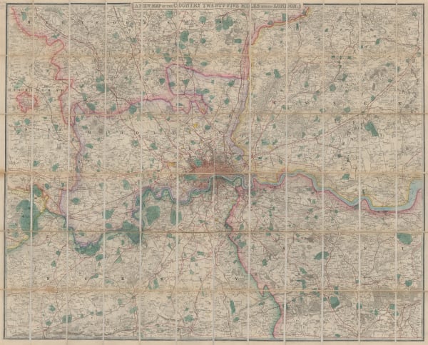
James Wyld, A New Map of the Country Twenty-Five Miles Round London, 1870 c.£ 2,250.00
-
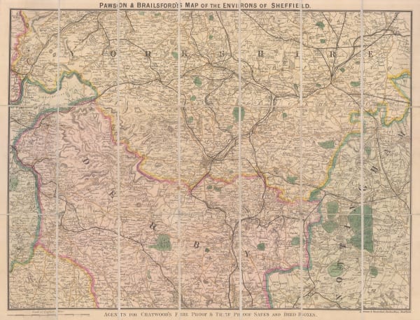
Pawson & Brailsford, Sheffield, 1870 c.£ 250.00
-
Archibald Fullarton, Australia and New Zealand, 1870 c.£ 445.00
-
Royal Geographical Society (RGS), A Map to Illustrate Captain Harcourts Paper on the Himalayan Valleys of Kooloo, Lahoul & Spiti, 1871£ 325.00
-
Alexandre Vuillemin, Folding map of Algeria, 1871£ 295.00
-
Justus Perthes, Chart of the World on Mercators Projection, 1871£ 3,250.00
-
Justus Perthes, Die Hauptsaechlichsten Gebiete Der Indianer Mission in den Verein Staaten, 1871£ 125.00
-
Justus Perthes, G.W. Hayward’s journey from Leh to Kashgar, 1871£ 98.00
-
Spanish Admiralty, Spanish Admiralty chart of the Chesapeake Bay, 1871£ 1,450.00
-
Royal Geographical Society (RGS), Map of Part of Nipon Island, 1871£ 145.00
-
Royal Geographical Society (RGS), Overland route from Perth to Adelaide , 1871£ 695.00
-
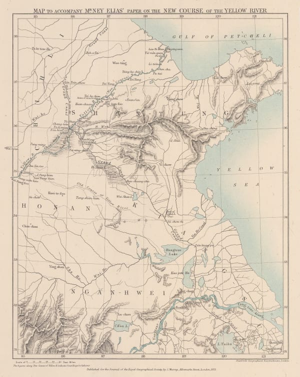
Royal Geographical Society (RGS), Map to accompany Mr Ney Elias' paper on the New Course of the Yellow River, 1871£ 165.00
-
Justus Perthes, North America showing missions and reservations, 1871£ 55.00
-
John Dower, Pacific Ocean, 1871£ 80.00
-
John Dower, Russia in Asia, 1871£ 55.00
-
Royal Geographical Society (RGS), Sketch Map of Mr. Baines' Routes Between the Limpopo and Zambesi Rivers, 1871£ 150.00
-
John Dower, Spain and Portugal, 1871£ 58.00
-
H.H. Lloyd & Co., Map of Texas, 1871£ 725.00
-
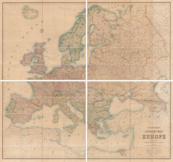
Edward Stanford, Stanford's Library Map of Europe, 1871£ 3,950.00
-
Justus Perthes, French military expeditions in Morocco, 1872£ 68.00
-
Justus Perthes, German Exploration in Gabon, 1872£ 88.00


Page
85
of 130