-
 J. Blumethal, Asia, 1842£ 70.00
 -
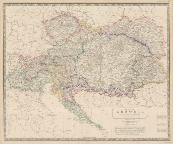
John Arrowsmith, Austrian Empire, 1842£ 425.00
-
Society for the Diffusion of Useful Knowledge (SDUK), Boston, 1842£ 695.00
-
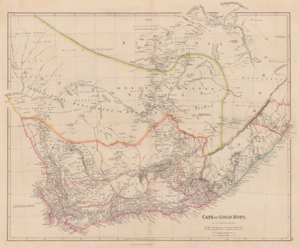
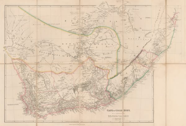
John Arrowsmith, Cape of Good Hope, 1842£ 850.00
-
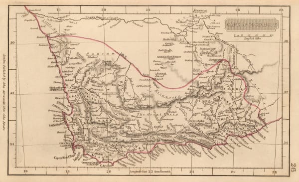
John Arrowsmith, Cape of Good Hope, 1842£ 68.00
-
Benedetto Marzolla, Carta Generale dell'Antartica, 1842£ 1,450.00
-
-
Society for the Diffusion of Useful Knowledge (SDUK), Southwestern United States and Northern Mexico, 1842£ 625.00
-
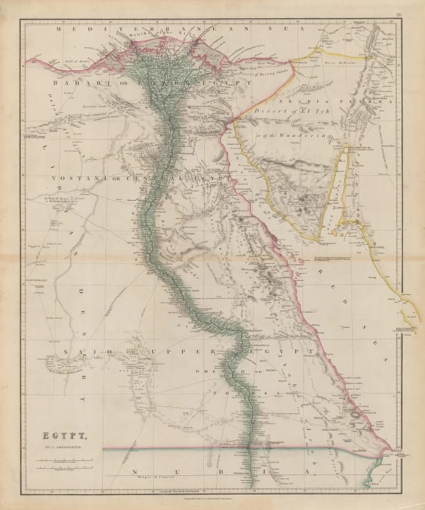
John Arrowsmith, Egypt, 1842£ 185.00
-
Royal Geographical Society (RGS), Frobisher Strait & Northumberland Inlet, 1842£ 145.00
-
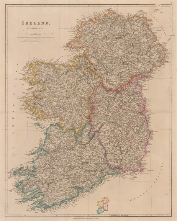
John Arrowsmith, Ireland, 1842£ 345.00
-
James Wyld, Lower Egypt or the Nile Delta, 1842£ 285.00
-
James Wyld, Map of Afghaunistan, Caubul, The Punjab, Rajpootana and the River Indus, 1842£ 1,950.00
-
James Wyld, North and South America with Pacific Ocean, 1842£ 750.00
-
J. & C. Walker, Map of the British Isles, 1842£ 1,450.00
-
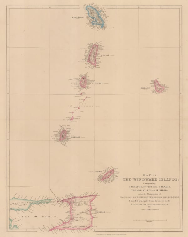
John Arrowsmith, Windward Isles, 1842£ 495.00
-
Thomas Kelly, Mexico & Guatemala, 1842£ 150.00
-
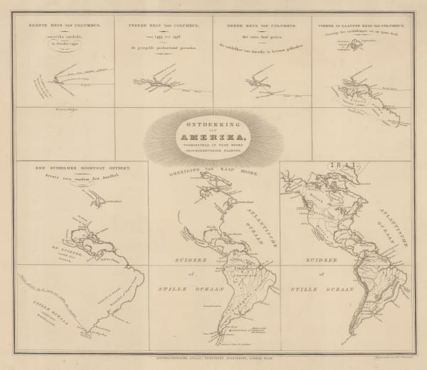
Daniel Veelward, The Discovery of America, 1842£ 350.00
-
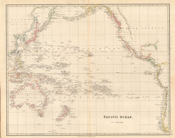
John Arrowsmith, Pacific Ocean, 1842£ 185.00
-
Forrester & Ruthven, Bath, 1842£ 58.00
-
Royal Geographical Society (RGS), Northwestern Iran, 1842£ 82.00
-
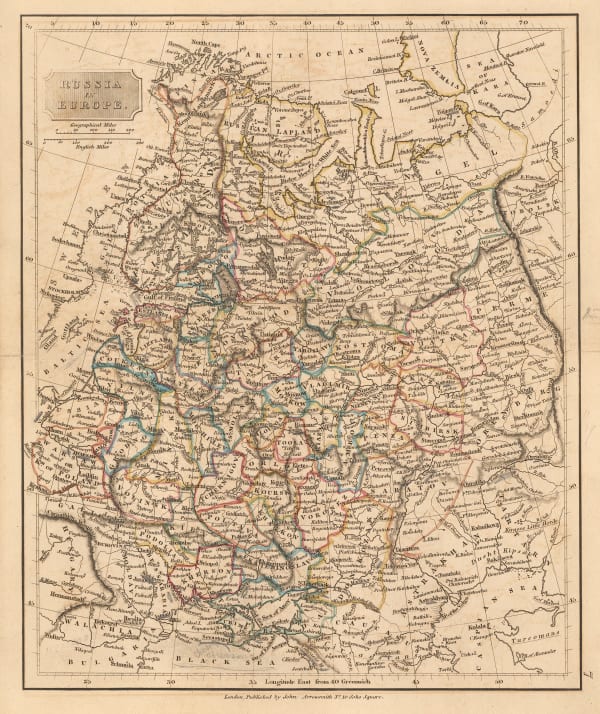
John Arrowsmith, Russia in Europe, 1842£ 52.00
-
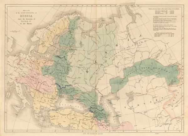
John Arrowsmith, Sketch of the Acquisitions of Russia since the Accession of Peter 1st to the Throne, 1842£ 495.00
-
Royal Geographical Society (RGS), Sketch of The Kuria-Muria Islands., 1842£ 68.00
-
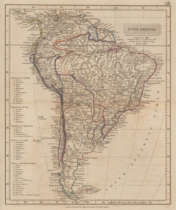
John Arrowsmith, South America, 1842£ 62.00
-
James Wyld, South America, 1842£ 94.00
-
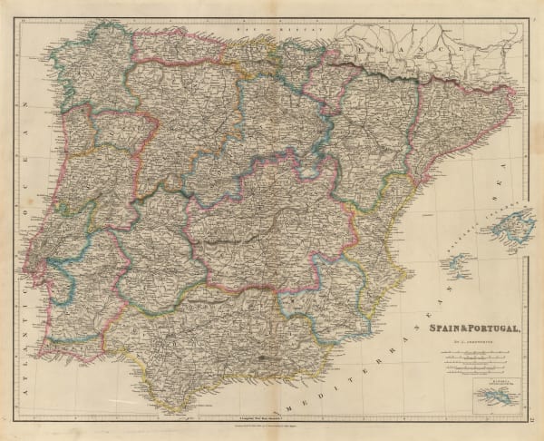
John Arrowsmith, Spain & Portugal, 1842£ 125.00
-
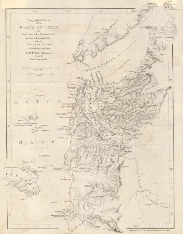
Royal Geographical Society (RGS), Topographical Survey of the Plain of Troy with the Ancient Sites, 1842£ 380.00
-
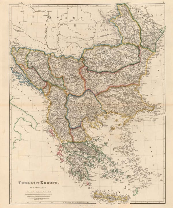
John Arrowsmith, Greece and the Balkans, 1842£ 245.00
-
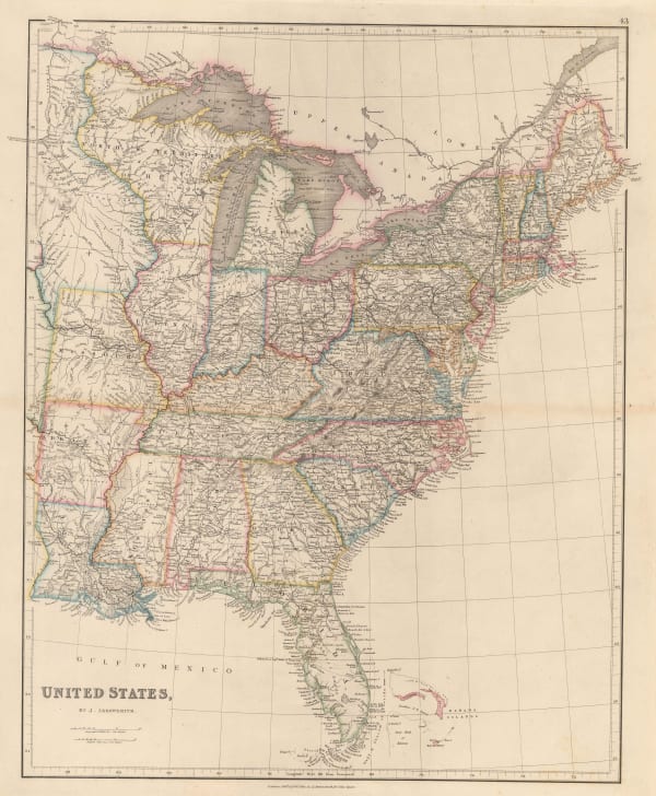
John Arrowsmith, Victorian map of the Eastern United States, 1842£ 595.00
-
John Arrowsmith, Detailed map of Tasmania, 1842£ 575.00
-
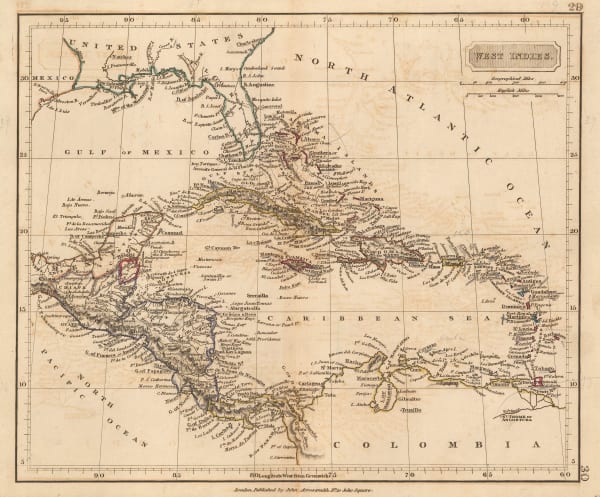
John Arrowsmith, West Indies, 1842£ 60.00
-
George Prickett, Plan of Highgate, 1842£ 595.00
-
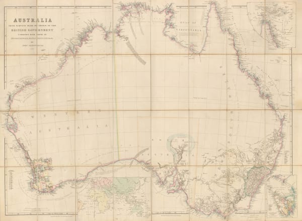
John Arrowsmith, Australia, 1842£ 2,850.00
-
John Arrowsmith, Cape of Good Hope, 1842£ 850.00
-
John Arrowsmith, South Italy, 1842£ 195.00
-
George Prickett, Highgate and Hornsey Park, 1842£ 395.00
-
-
W. & A.K. Johnston, Austrian Empire, 1842 c.£ 95.00
-
Joshua Archer, Asia, 1843£ 78.00
-
Thomas Kelly, Asia, 1843£ 50.00
-
Jean-Denis Barbié du Bocage, South America, 1843£ 140.00
-
French Admiralty, Chart of the Gulf of Mexico, 1843£ 885.00
-
British Admiralty, France South Coast: Port Vendre, 1843£ 50.00
-
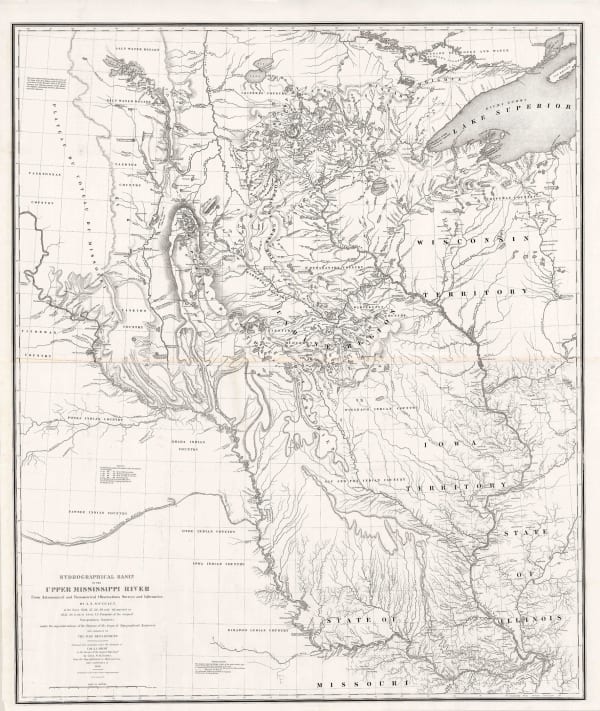
Joseph Nicolas Nicollet, Hydrographical Basin of the Upper Mississippi River, 1843£ 3,450.00
-
Charles Frederick Cheffins, Map of the English and Scottish Railways, 1843£ 475.00
-
Joseph Meyer, West Indies and Central America, 1843£ 165.00
-
J. & C. Walker, Northamptonshire, 1843£ 75.00
-
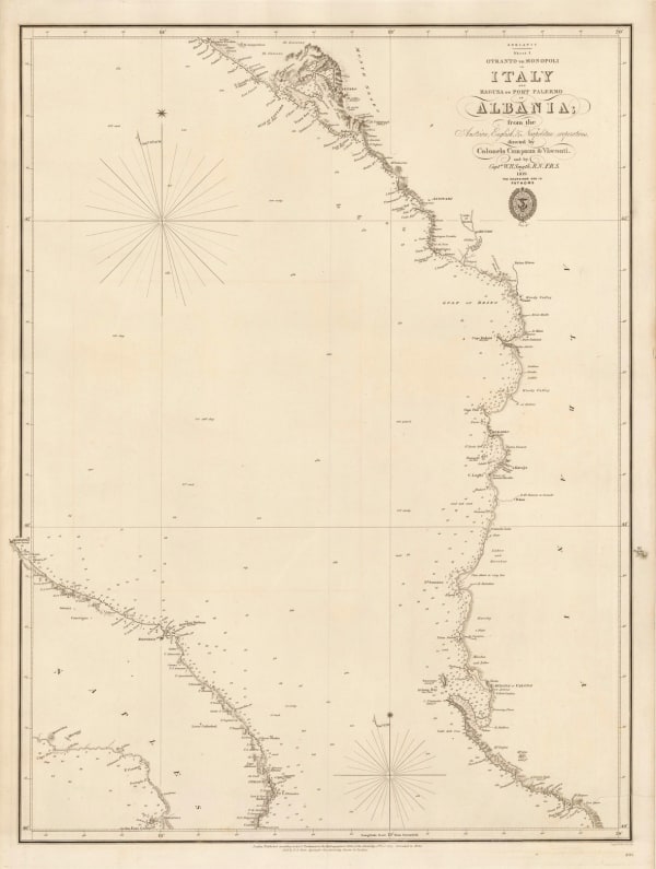
British Admiralty, Otranto to Monopoli in Italy and Ragusa to Port Palermo in Albania, 1843£ 185.00
-
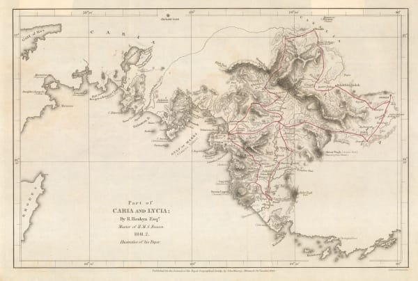
Royal Geographical Society (RGS), Part of Caria and Lycia / Muğla Province, 1843£ 115.00
-
Eugenio Rodriguez, Chart of Rio de Janeiro, 1843£ 2,950.00
-
John Lee, Cheltenham, 1843£ 125.00
-
Joshua Archer, Russia in Europe and Poland, 1843£ 66.00
-
Thomas Tegg, United States, 1843£ 55.00
-
Royal Geographical Society (RGS), Natron Lakes of Egypt, 1843£ 145.00
-
Edward Wallis, Wallis's Guide for Strangers through London, 1843£ 1,350.00
-
Joseph Meyer, America, 1843£ 145.00
-
Alexandre Vuillemin, Pictorial plan of Paris, 1843£ 650.00
-
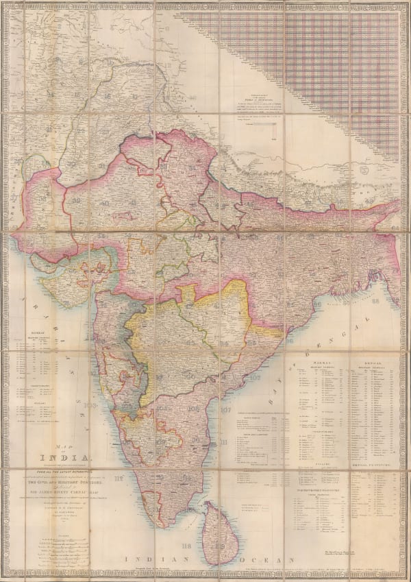
James Wyld, Map of India, 1843£ 2,250.00
-
Samuel Augustus Mitchell, National Map of the American Republic, 1843£ 1,450.00
-
Samuel Augustus Mitchell, US Cities and Statistics, 1843£ 1,150.00
-
Society for the Diffusion of Useful Knowledge (SDUK), Arabia with Egypt, Nubia and Abyssinia, 1843£ 595.00
-
James Wyld, A Map of Ireland, 1844£ 595.00
-
John William Norie, A Set of Celestial Maps intended to assist Students in Astronomy, and Seamen in general, In acquiring a knowledge of the Principal Fixed Stars in the Heavens., 1844£ 875.00
-
John Arrowsmith, America, 1844£ 1,950.00
-
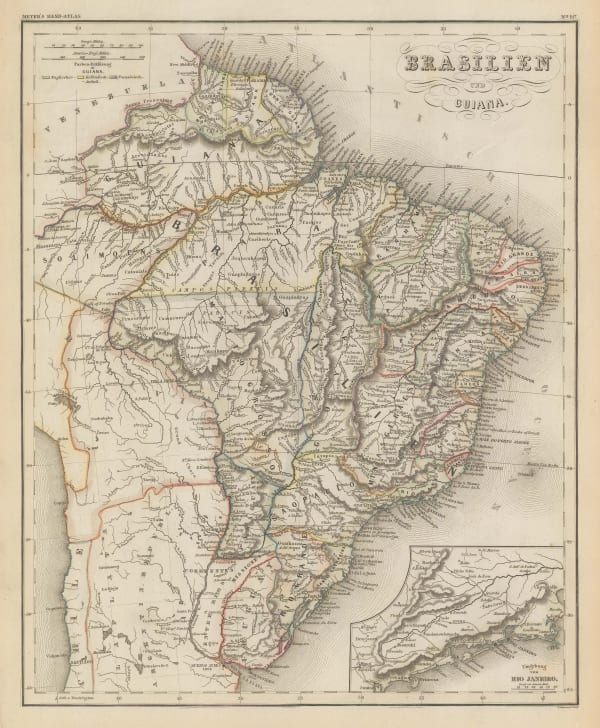
Joseph Meyer, Brazil and Guyana, 1844£ 195.00
-
W. & A.K. Johnston, Chart of the World on Mercator's Projection, 1844£ 575.00
-
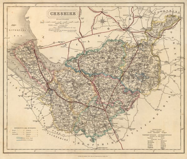
J. & C. Walker, Cheshire, 1844£ 75.00
-
Ashford & Loader, Geological Map of England and Wales, 1844£ 625.00
-
J. & C. Walker, Leicestershire, 1844£ 44.00
-
Royal Geographical Society (RGS), Map Illustrating Dr. Beke's Journey through Abyssinia, 1844£ 175.00
-
James Wyld, Map of Africa, 1844£ 1,250.00
-
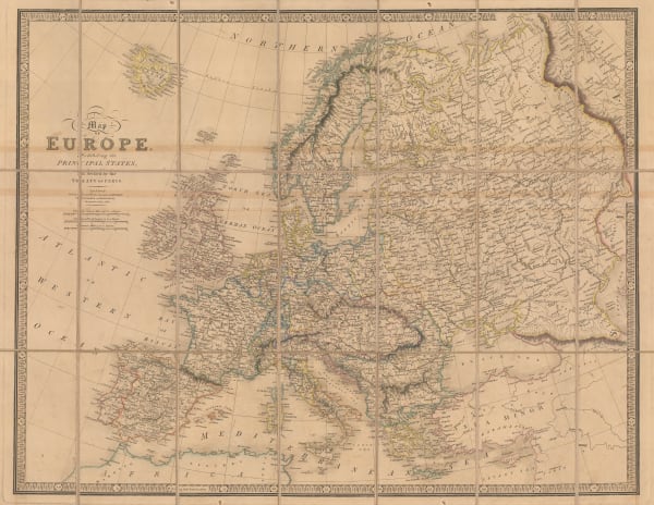
James Wyld, Map of Europe, 1844£ 895.00
-
James Wyld, German Confederation, 1844£ 375.00
-
Charles J. Muggeridge, Map of the Hop District of Kent and Sussex, 1844£ 1,200.00
-
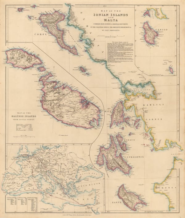
John Arrowsmith, Map of the Ionian Islands and Malta, 1844£ 325.00
-
-
James Gilbert, Map of the World on Mercator's Projection, 1844£ 4,850.00
-
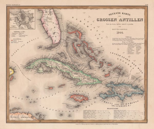
Joseph Meyer, The Greater Antilles, 1844£ 225.00
-
Joseph Meyer, Egypt, the Nile and Nubia (Sudan), 1844£ 115.00


Page
69
of 130