-
 Nicolas & Guillaume Sanson, Kingdom of Congo, 1700£ 495.00
 -
Nicolas & Guillaume Sanson, European Russia, 1700£ 585.00
-
Nicolas Sanson, Syria, Iraq, the Levant, and Kurdistan, 1700£ 395.00
-
John Oliver, St. Albans, 1700£ 795.00
-
Heinrich Scherer, Typus Totius Orbis Terraquei Geographice Delineatus, et Ad Usum Globo Materiali Superinducendus, 1700£ 1,650.00
-
Nicolas & Guillaume Sanson, Astronomical Diagrams, 1700£ 245.00
-
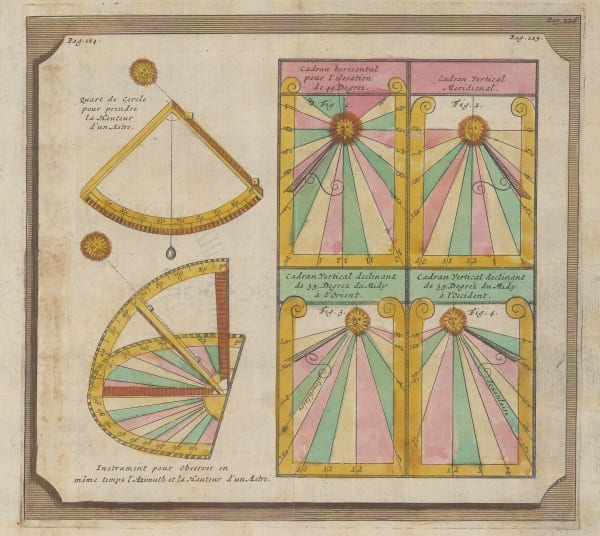
Nicolas & Guillaume Sanson, Astronomical Diagrams - Sextants & Sundials, 1700£ 245.00
-
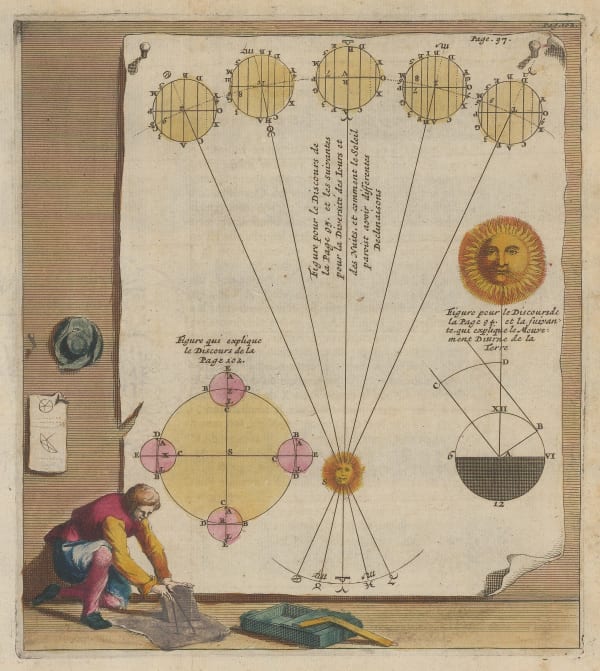
Nicolas & Guillaume Sanson, Astronomical Diagrams - the Earth's Revolution, 1700£ 245.00
-
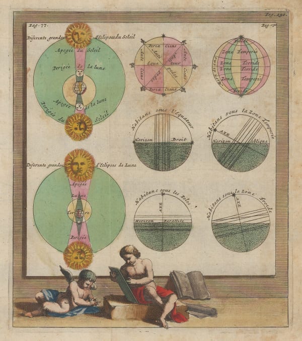
Nicolas & Guillaume Sanson, Astronomical Diagrams - Eclipses, 1700£ 245.00
-
Nicolas & Guillaume Sanson, Astronomical Diagrams - Earth's Orbit, 1700£ 245.00
-
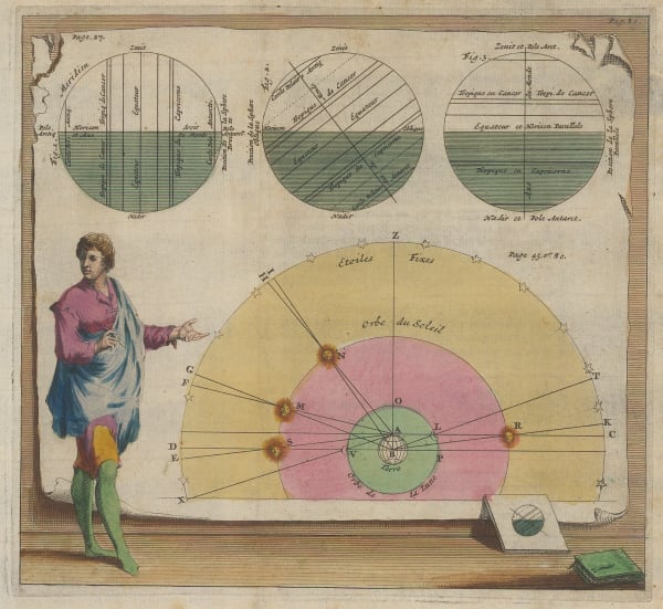
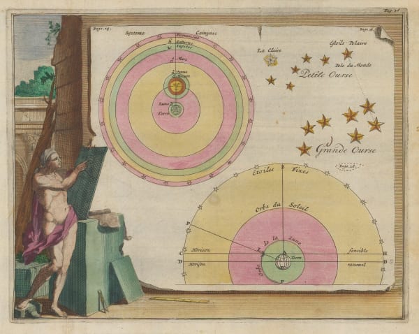
Nicolas & Guillaume Sanson, Astronomical Diagrams - the Solar System, 1700£ 245.00
-
Nicolas & Guillaume Sanson, Black Sea, 1700£ 375.00
-
Nicolas & Guillaume Sanson, West Africa & Cabo Verde, 1700£ 265.00
-
Robert Morden, Germany and the Holy Roman Empire, 1700 c£ 88.00
-
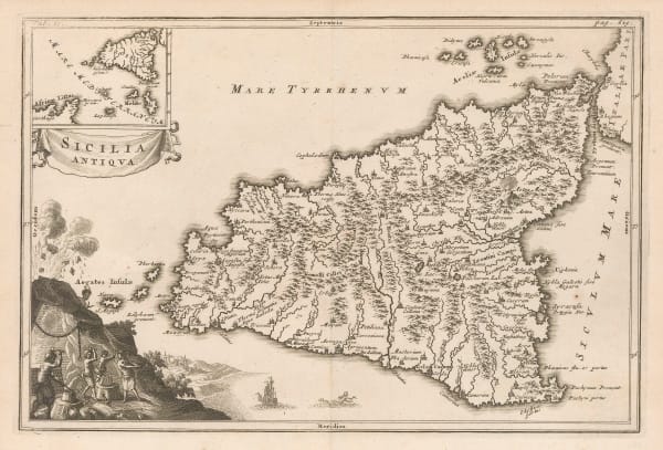
Christoforus Cellarius, Ancient Sicily, 1700 c£ 375.00
-
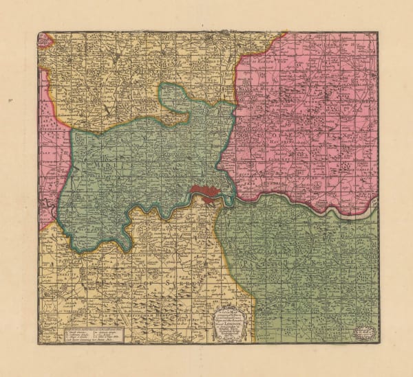
Herman Moll, London and its Environs 20 Miles Around, 1700 c.£ 375.00
-
Edward Wells, A New Map of the Terraqueous Globe according to the Ancient Discoveries, 1700 c.£ 2,750.00
-
Johann Baptist Homann, Map and Panoramic View of London, 1700 c.£ 4,950.00
-
-
-
Heinrich Scherer, Baja California and Mexico, 1700 c.£ 985.00
-
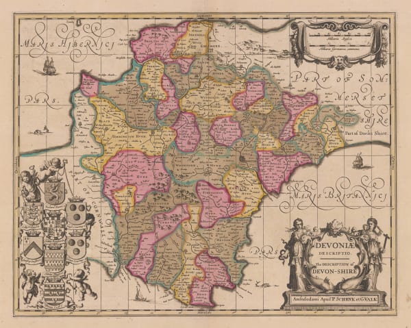
Valk & Schenk, Devoniae, 1700 c.£ 885.00
-
Jan van Jagen, Ierusalem, 1700 c.£ 475.00
-
Valk & Schenk, Guangxi, Yunnan, Guangdong and Guizhou provinces, 1700 c.£ 2,450.00
-
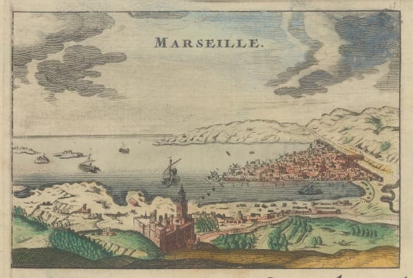
Alexis-Hubert Jaillot, Marseille, 1700 c.£ 155.00
-
Jacob von Sandrart, Nova Tabula Americae, 1700 c.£ 2,950.00
-
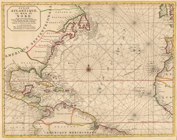
Pierre Mortier, Chart of the North Atlantic Ocean, 1700 c.£ 1,950.00
-
Romeyn De Hooghe, Unusual map of the Middle East illustrating Biblical geography, 1700 c.£ 825.00
-
-
Johannes van Keulen, Chart of the Lesser Antilles, 1700 c.£ 1,550.00
-
Johannes van Keulen, Chart of the Balearic Islands and Spanish coast, 1700 c.£ 2,350.00
-
Heinrich Scherer, Planisphaerium ex Polo Artico, 1700 c.£ 450.00
-
Heinrich Scherer, North America showing the reach of Catholic missionaries, 1700 c.£ 1,750.00
-
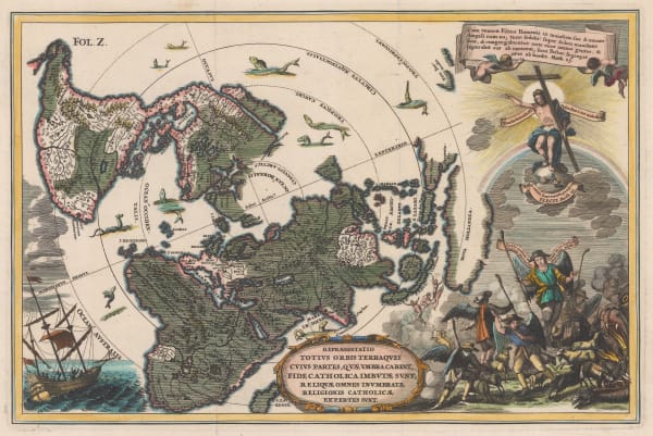
Heinrich Scherer, Repraesentatio Totius Orbis Terraquei Cuius Partes, Quae Umbra Carent, Fide Catholica Imbutae Sunt, Reliquae Omnes Inumbratae Religionis Catholicae Expertes Sunt., 1700 c.£ 1,275.00
-
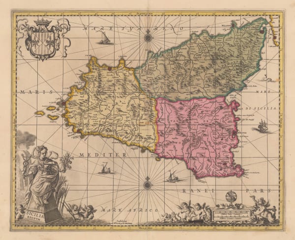
Valk & Schenk, Dutch Golden Age map of Sicily, 1700 c.£ 1,250.00
-
Valk & Schenk, Sumatra and Singapore Straits, 1700 c.£ 2,000.00
-
Valk & Schenk, Lebanon and Syria, 1700 c.£ 825.00
-
Capt. Greenvile Collins, The Islands of Scilly, 1700 c.£ 1,450.00
-
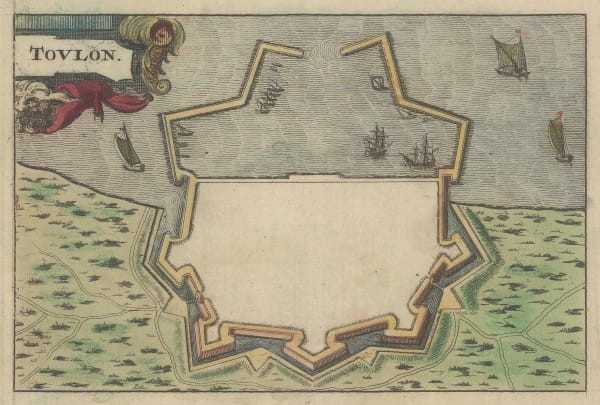
Alexis-Hubert Jaillot, Toulon, 1700 c.£ 155.00
-
Heinrich Scherer, World Map, 1700 c.£ 2,650.00
-
Edward Wells, Educational map of Asia, 1700 c.£ 445.00
-
Guillaume De L'Isle, Turkey, Arabia and Persia (Iran), 1701£ 1,150.00
-
Robert Morden, Cornwall, 1701£ 295.00
-
Robert Morden, Denbigh Shire, 1701£ 135.00
-
Robert Morden, Flintshire, 1701£ 115.00
-
Robert Morden, Monmouthshire, 1701£ 75.00
-
Robert Morden, Radnor Shire, 1701£ 48.00
-
Heinrich Scherer, Regionvm Circvm Polarivm, 1701£ 950.00
-
Robert Morden, The Isle of Mona, now Anglesey, 1701£ 125.00
-
Olfert Dapper, The City and Harbour of Rhodes, 1702£ 375.00
-
Guillaume De L'Isle, The British Isles, 1702£ 925.00
-
Nicolas de Fer, Scarce map of Southeast Asia, 1702£ 885.00
-
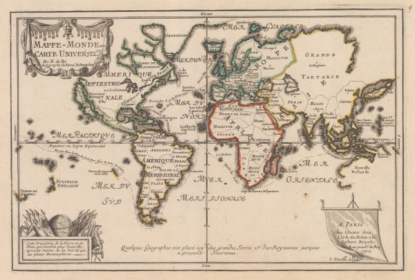
Nicolas de Fer, Mappe-Monde ou Carte Universelle, 1702£ 1,450.00
-
Nicolas de Fer, Southern & Central Africa, 1702£ 795.00
-
Nicolas Visscher, The Voyages of St. Paul the Apostle, 1702£ 850.00
-
Nicolas Visscher, The Biblical World in the Old Testament, 1702£ 785.00
-
Jacob & Hendrik Keur, Double Hemisphere World Map, 1702£ 3,950.00
-
Jeremiah Seller, Chart of the Atlantic and the West Indies, 1703£ 1,750.00
-
Gabriel Bodenehr, Carta Hydrographica oder Algemeine Welt und Commercien Carte, 1704£ 750.00
-
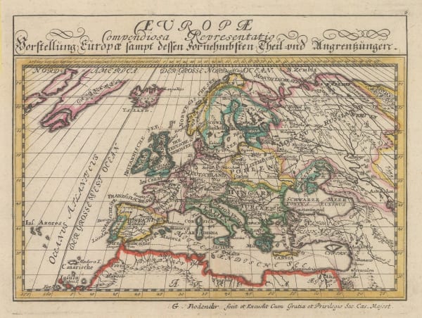
Gabriel Bodenehr, Europe, 1704£ 245.00
-
Pierre Mortier, Florence, 1704£ 3,450.00
-
John Harris, Africa, 1705£ 385.00
-
Guillaume De L'Isle, Duchy of Brabant, 1705£ 280.00
-
Nicolas & Guillaume Sanson, The Canary Islands, 1705£ 545.00
-
Nicolas de Fer, Bourges, Centre-Val de Loire, 1705£ 235.00
-
Nicolas de Fer, Asia, 1705£ 380.00
-
Nicolas de Fer, Tartar Empire, China, Japan and Kingdom of Korea, 1705£ 785.00
-
Nicolas de Fer, Magellan Straits, 1705£ 550.00
-
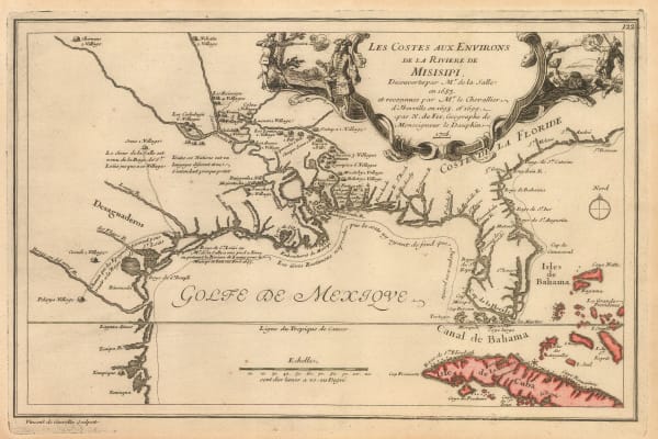
Nicolas de Fer, Mississippi River, Florida and the Gulf of Mexico, 1705£ 2,650.00
-
Nicolas de Fer, Caribbean or the West Indies, 1705£ 950.00
-
Nicolas de Fer, India and the Malay Peninsula, 1705£ 500.00
-
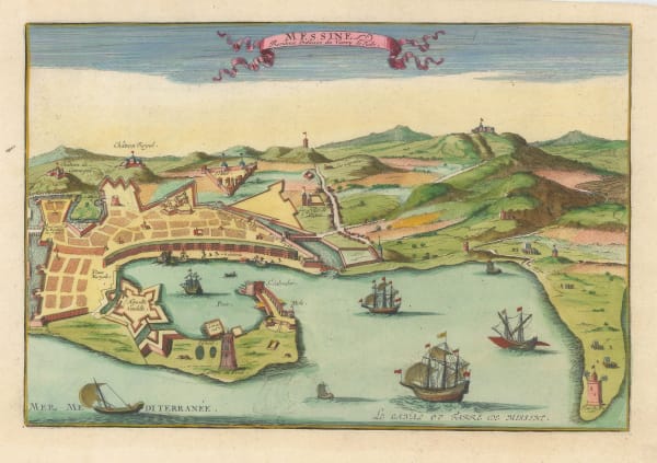
Nicolas de Fer, Bird's-eye view of Messina, 1705£ 385.00
-
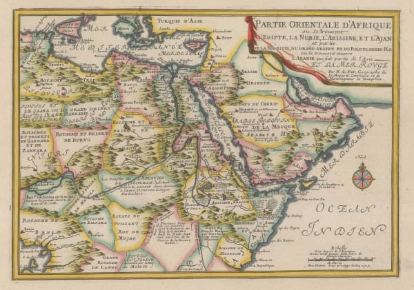
Nicolas de Fer, Northeast Africa, 1705£ 420.00
-
Nicolas de Fer, City plan of Dijon, 1705£ 220.00
-
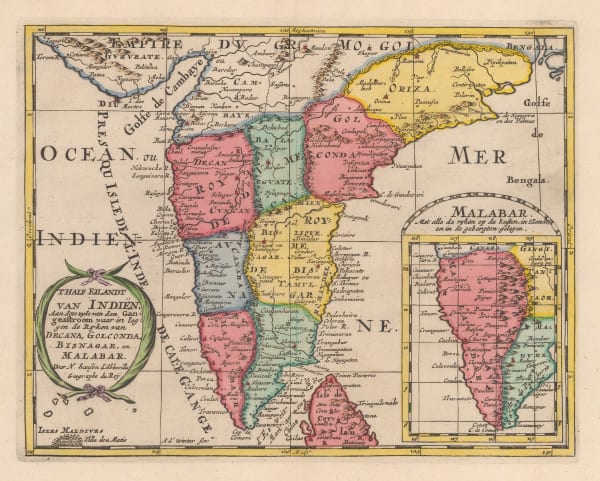
Nicolas & Guillaume Sanson, T'Half Eilandt van Indien, 1705£ 325.00
-
Herman Moll, This Draught of the North Pole is to shew all the Countries near and adjacent to it, 1705£ 1,450.00
-
Nicolas de Fer, Turin et ses Environs, 1705£ 1,950.00
-
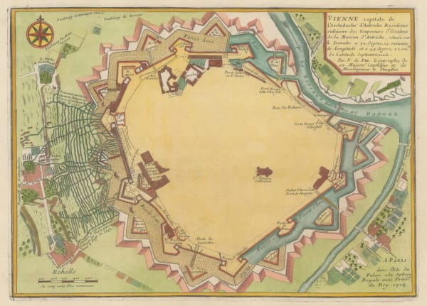
Nicolas de Fer, Vienna, 1705£ 400.00
-
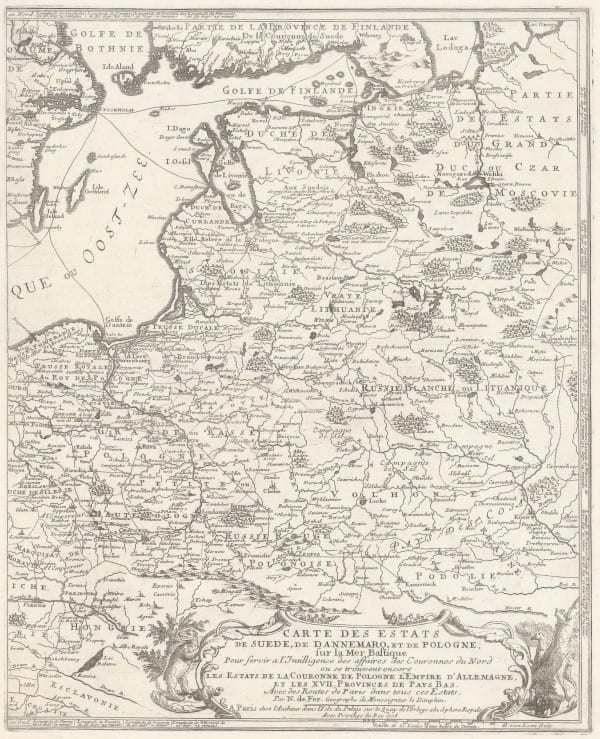
Nicolas de Fer, Poland & the Baltic States, 1705£ 550.00
-
Nicolas de Fer, Antwerp, 1705£ 325.00


Page
20
of 130