-
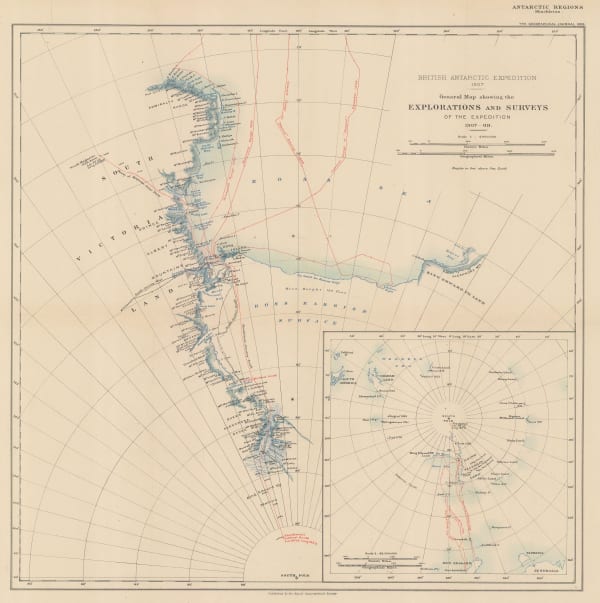
 Royal Geographical Society (RGS), Shackleton's British Antarctic Expedition, 1909£ 2,200.00
 -
Royal Geographical Society (RGS), Routes and Surveys of the South Magnetic Polar Party, 1909£ 1,650.00
-
William Heinemann, British Antarctic Expedition 1907, Routes and Surveys of the Southern Journey Party 1908- 09, 1909 c.£ 3,500.00
-
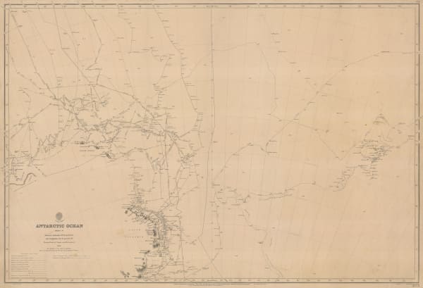
British Admiralty, Antarctic Ocean Sheet IV, 1910£ 3,500.00
-
Royal Geographical Society (RGS), North Polar Region - Sketch map to illustrate the Expedition of Commander R.E.Peary, U.S.N. 1908-1909, 1910£ 275.00
-
Royal Geographical Society (RGS), Maps to Illustrate the Paper by Dr. J.B. Charcot on the French Antarctic Expedition 1908-1910, 1911£ 750.00
-
Royal Geographical Society (RGS), South Polar Regions, 1911£ 1,850.00
-
W. & A.K. Johnston, North Polar Chart, 1912 c£ 225.00
-
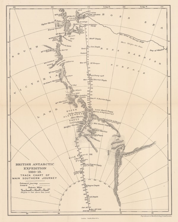
Edward Stanford, British Antarctic Expedition 1910-13. Track chart of the main southern journey, 1913£ 450.00
-
Royal Geographical Society (RGS), Preliminary Chart showing the Deep Sea Soundings taken on board the 'Aurora' during the 1st and 2nd years work of the Australasian Antarctic Expedition, 1913£ 600.00
-
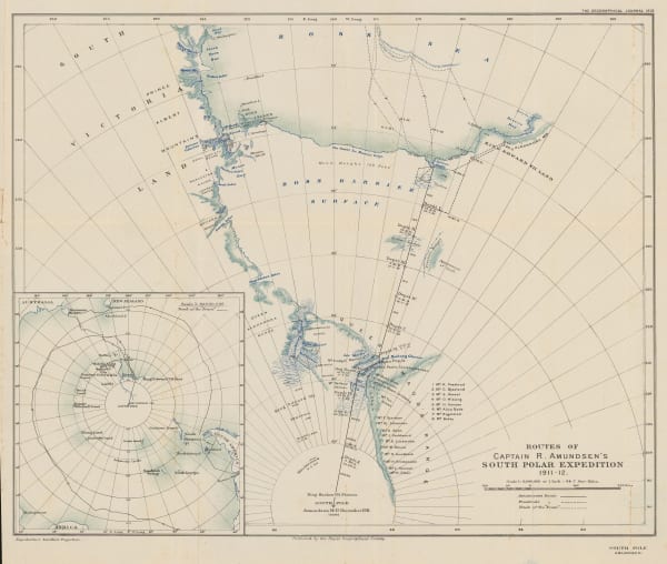
Royal Geographical Society (RGS), Routes of Captain R. Amundsen's South Polar Expedition 1911-1912, 1913£ 4,950.00
-
Edward Stanford, Sketch Map of Mount Erebus, 1913£ 150.00
-
Royal Geographical Society (RGS), Sketch Map to Illustrate Einar Mikkelsen's Expedition to North East Greenland 1909-12, 1913£ 88.00
-
George Philip & Son Ltd., The Polar Regions, 1913 c.£ 395.00
-
British Admiralty, Heroic Age map of the Ross Sea & Ross Ice Shelf, 1914£ 4,500.00
-
Royal Geographical Society (RGS), Australasian Antarctic Expedition - King George V Land, 1914£ 2,450.00
-
Royal Geographical Society (RGS), Australasian Antarctic Expedition, 1911 - 14. Queen Mary Land, Showing the tracking of the Sledging Parties from the Main Base, 1914£ 1,600.00
-
Royal Geographical Society (RGS), Regional Map Showing the Area Covered by the Australasian Antarctic Expedition, 1914£ 795.00
-
Royal Geographical Society (RGS), Sketch Map to illustrate the paper by Raymond E. Priestly on The Work of the Northern Party, 1914£ 675.00
-
Edward Stanford, The field of work of the Mawson Expedition., 1915 c.£ 48.00
-
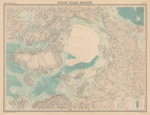
John Bartholomew, North Polar Regions, 1922£ 345.00
-
John Bartholomew, South Polar Regions, 1922£ 725.00
-
John Bartholomew, Map of the North Polar Regions for "A Naturalist at the Poles", 1923£ 195.00
-
John Bartholomew, Map of the South Polar Regions for "A Naturalist at the Poles", 1923£ 975.00
-
Royal Geographical Society (RGS), Chart Showing the discoveries and approximate track of Edward Bransfield, Master R.N. In the hired brig "Willims" of Blyth, when exploring the South Shetland Islands and the northern extremity of Graham Land, in the year 1820, 1925£ 850.00
-
J. Gordon Hayes, No. 1, Antarctica, 1928£ 795.00
-
J. Gordon Hayes, No. 4 The Ross Dependancy, 1928£ 695.00
-
Royal Geographical Society (RGS), Discoveries in Graham Land by Sir Hubert Wilkins, December, 1928, 1929£ 450.00
-
Royal Geographical Society (RGS), Recent Work of Norwegian Expeditions in the Antarctic Regions, 1931£ 375.00
-
Royal Geographical Society (RGS), Antarctic Regions, 1932£ 1,400.00
-
Surveys and Soundings of the R.R.S. Discovery II, 1932Royal Geographical Society (RGS)Series: LondonRoyal Geographical Society (RGS), Surveys and Soundings of the R.R.S. Discovery II, 1932£ 280.00
-
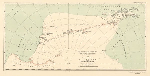
Royal Geographical Society (RGS), Map to illustrate the paper on the "First Crossing of Antarctica", 1937£ 650.00
-
Royal Geographical Society (RGS), The Course of Antarctic Exploration between Longitudes 20W and 110E, 1939£ 850.00
-
Royal Geographical Society (RGS), British Graham Land Expedition, 1940£ 1,550.00
-
Royal Geographical Society (RGS), British Antarctic Territory - Alexander Island and Charcot Island, 1963£ 295.00


Page
2
of 2