-
 Sebastian Münster, De Insulis, 1558£ 120.00
 -
 Athanasius Kircher, Geographia Conjecturalis de Orbis Terrestris Post Diluvium, 1675£ 3,650.00
 -
 Die Ebbe und Fluth auff einer Flachen Landt-Karten Furgestelt, 1708Eberhard Werner HappelSeries: UlmEberhard Werner Happel, Die Ebbe und Fluth auff einer Flachen Landt-Karten Furgestelt, 1708£ 2,750.00
 -
 Jacques-Nicolas Bellin, Map of the Trade Winds in the Pacific Ocean, 1753£ 345.00
 -
 Jacques-Nicolas Bellin, Map of the Trade Winds in the Atlantic and Indian Oceans, 1753£ 345.00
 -

-
 John Wilkes, Projections of the Sphere, and common Terrestrial Globe, 1807£ 145.00
 -
 India & the Middle East as it was known during the Classical Era, 1807Robert WilkinsonSeries: LondonRobert Wilkinson, India & the Middle East as it was known during the Classical Era, 1807£ 115.00
 -
 Edward Quin, A.D. 1100. Period of the First Crusade, 1830 c.£ 245.00
 -
 Edward Quin, A.D. 1294. The Empire of Kublai Khan, 1830 c.£ 545.00
 -
 Edward Quin, A.D. 1551. At the Death of Charles V., 1830 c.£ 495.00
 -
 Edward Quin, A.D. 1828. End of the General Peace, 1830 c.£ 495.00
 -
 Edward Quin, A.D. 1660. At the Restoration of the Stuarts, 1830 c.£ 495.00
 -
 Thomas Bradford, Distribution of Vegetables and Snow Line / Comparative Lengths of Rivers, 1835£ 115.00
 -
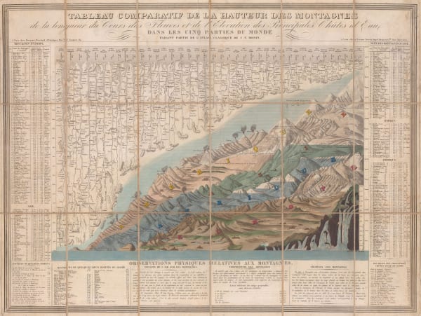
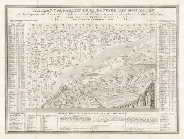
 Charles V. Monin, Comparative View of the Mountains, Rivers & Waterfalls of the World, 1839 c.£ 1,750.00
 -
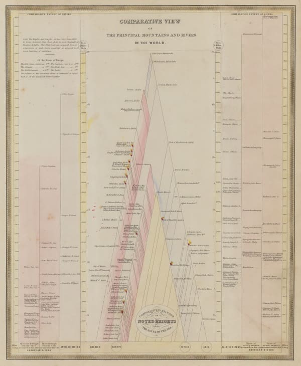
 Sidney Hall, Compartative View of the Principal Mountains and Rivers in the World, 1840 c.£ 475.00
 -
 Charles V. Monin, Tableau Comparatif de la Hauteur des Montagnes, 1840 c.£ 475.00
 -
 Ashford & Loader, The Heights of the Mountains of the Eastern Hemisphere, 1845£ 975.00
 -
 Humphrey Phelps, Pictorial View of the World, 1846£ 1,950.00
 -
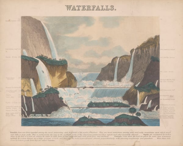
 James Reynolds, Waterfalls, 1846 c.£ 545.00
 -
 James Reynolds, Geological Map of the World, 1850 c£ 545.00
 -
 John Tallis, Overland Route to India, 1851£ 425.00
 -
 James Reynolds, Phenomena of Volcanoes and Earthquakes, 1852£ 495.00
 -
 Edward Quin, A.D. 1660. At the Restoration of the Stuarts, 1856£ 385.00
 -
 Edward Quin, A.D. 476. The Dissolution of the Western Empire, 1856 c.£ 125.00
 -
 William Buckland, Ideal Section of a Portion of the Earth's Crust, 1858£ 2,250.00
 -
 Edward Quin, A.D. 1783. Independence of the United States, 1865 c.£ 495.00
 -
 Edward Quin, A.D. 395, The Division of the Roman Empire, 1865 c.£ 175.00
 -
 British Admiralty, Chart of the Curves of Equal Magnetic Variation 1858., 1867£ 825.00
 -
 Justus Perthes, Overview Map of Alexander von Humboldt's Travels, 1869£ 225.00
 -
 A. Simon, Planisphere, 1885£ 125.00
 -
 Royal Geographical Society (RGS), Map of the World on Mercator's Projection, 1886£ 235.00
 -
 Scottish Geographical Society (SGS), The Geographical Value of The Best Maps of All Countries of The World, 1890£ 425.00
 -
 Scottish Geographical Society (SGS), The Evolution of the Continents, 1890£ 175.00
 -
 Anonymous, Rivers and Mountains, 1890 c£ 195.00
 -
 William Collins, Map of the World Showing the Distribution of Rain & Snow, 1890 c.£ 75.00
 -
 George Philip & Son Ltd., The British Empire, 1890 c.£ 375.00
 -
 Justus Perthes, Annual Temperatures of the World's Oceans, 1893£ 145.00
 -
 Royal Geographical Society (RGS), Earthquake Districts of the World, 1903£ 165.00
 -
 G. & J. Bartholomew, Commercial Development of the World, 1905 c.£ 145.00
 -
 G. & J. Bartholomew, Silver and Lead Mining Countries, 1905 c.£ 115.00
 -
 G. & J. Bartholomew, British Naval Chart, 1906£ 125.00
 -
 G. & J. Bartholomew, Gold Mining Countries, 1906£ 145.00
 -
 G. & J. Bartholomew, Rubber Growing Countries, 1906£ 125.00
 -
 G. & J. Bartholomew, Iron Mining Countries, 1906£ 125.00
 -
 G. & J. Bartholomew, Ivory, Gums, Resin, Wax, &c., 1906£ 95.00
 -
 G. & J. Bartholomew, States and British Representation, 1906£ 345.00
 -
 John Bartholomew, Sugar - Growing Countries, 1906£ 125.00
 -
 John Bartholomew, Timber - Growing Countries, 1906£ 125.00
 -
 G. & J. Bartholomew, Total British Trade, 1906£ 125.00
 -
 John Bartholomew, Wheat - Growing Countries, 1906£ 125.00
 -
 George Morrell, Manuscript Caricature map of the World in Anguish, 1910 c.£ 2,450.00
 -
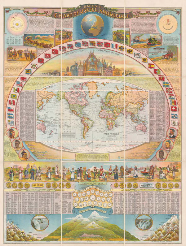
 George W. Bacon, Bacon's Chart of Useful Knowledge, 1910 c.£ 3,600.00
 -
 German Government, Freiheit der Meere, 1918£ 1,500.00
 -
 Sifton Praed & Co., Naval Bases of The Great Powers, 1933£ 725.00
 -
 Anonymous, The British Empire in the Jubilee Year of King George V, 1935£ 500.00
 -

-
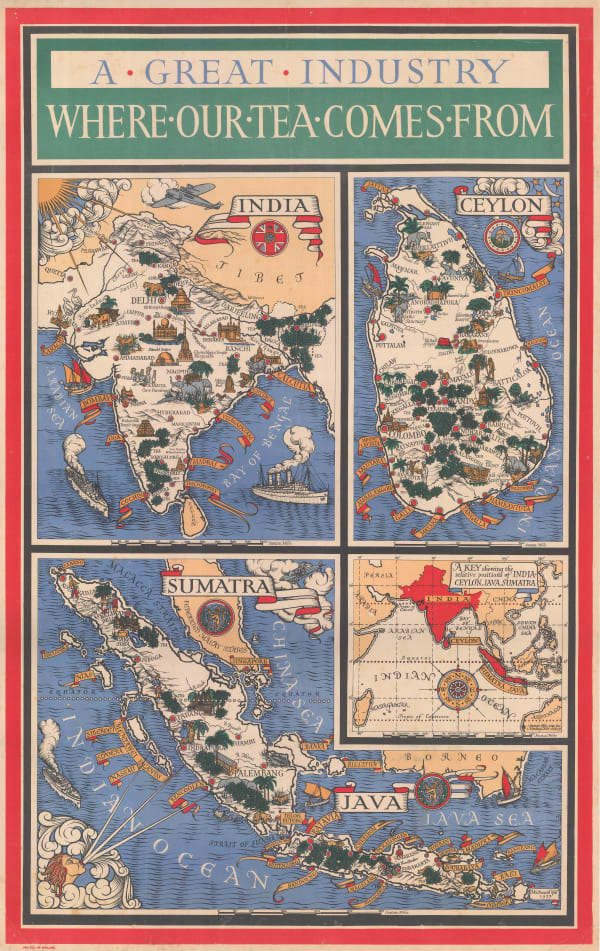
 MacDonald Gill, A Great Industry - Where Our Tea Comes From, 1937£ 4,950.00
 -
 Alonzo C. Webb, The Commonwealth of Nations - Or the British Empire, 1937£ 950.00
 -
 Air France, Air France 'Reseau Aerien Mondial', 1937 c.£ 4,500.00
 -
 Thomas Skinner, Air Routes of the World, 1938£ 900.00
 -
 F.E. Cheeseman, Wings Over the World... Yesterday, Today and Tomorrow - Aviation Cavalcade, 1942£ 750.00
 -
 Anonymous, German Propaganda map attacking the Atlantic Charter, 1942 c.£ 4,500.00
 -
 Aluminum Company of America (ALCOA), Global Map for Global War and Global Peace, 1943£ 650.00
 -
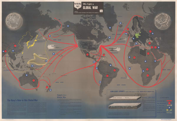
 US Navy Educational Services Section, Nav War Map No. 6 - We Fight A Global War, 1944£ 2,200.00
 -
 News Map of the Week, WW2 News Map for September 1944, 1944£ 525.00
 -
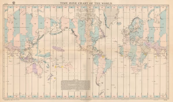
 United States Hydrographic Office, Time Zone Chart of the World, 1944£ 785.00
 -
 Boris Artzybasheff, World Map of the Major Tropical Diseases, 1944£ 525.00
 -

-
 Pict. Charts Service, USA and the World Today, 1949£ 695.00
 -
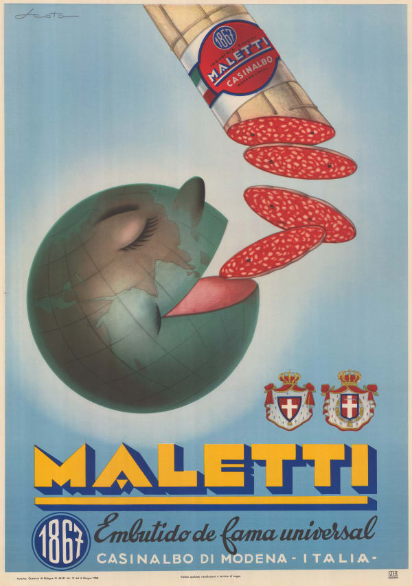
 Maletti, Maletti's "World Famous Salami" Poster, 1950 c.£ 1,500.00
 -
 Jacques Liozu, Pictorial Map of the World, 1951£ 225.00
 -
 US Air Force, Physical-Political Global Chart of the World, 1953£ 375.00
 -
 Raymond Tooby, Queen Elizabeth II's Commonwealth Tour, 1953£ 350.00
 -
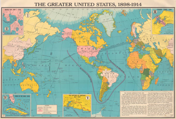
 Franklin Scott, The Greater United States 1898-1914, 1954£ 445.00
 -
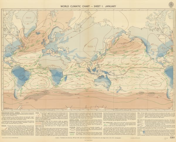
 British Admiralty, World Climate Chart - January, 1956£ 275.00
 -
 British Admiralty, World Climate Chart - July, 1956£ 275.00
 -
 LIFE Magazine, The New Portrait of Our Planet - The Earth without Water, 1960£ 2,500.00
 -
 Peter Ray, Main Areas of Tea Production, 1963£ 750.00
 -
 Radio Society of Great Britain, Great Circle DX Map, 1979£ 295.00
All Maps
Page
1
of 2


