Philippe Vandermaelen
Early map of Vancouver Island and southern British Columbia, 1827
19 ½ x 22 ½ in
49 x 57 cm
49 x 57 cm
CAN2802
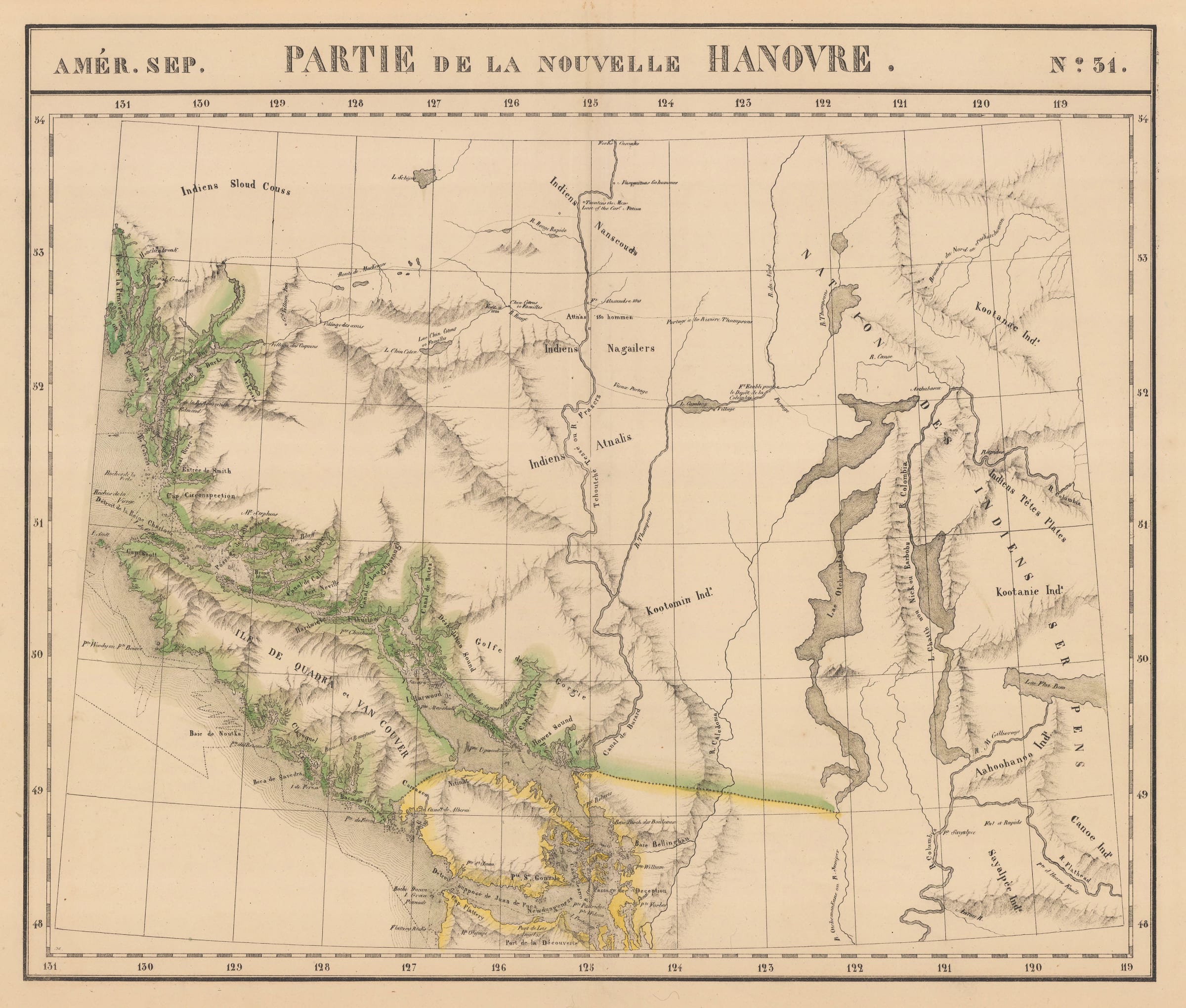
Partie de la Nouvelle Hanovre An early and detailed map of Vancouver Island and southern British Columbia from Vandermaelen's 'Atlas Universel'. New Hanover, the original name given to northern...
Partie de la Nouvelle Hanovre
An early and detailed map of Vancouver Island and southern British Columbia from Vandermaelen's "Atlas Universel". New Hanover, the original name given to northern British Columbia by George Vancouver, is used in the title of the map.
The cartographer, Philippe Vandermaelen, was born in Brussels in 1795 and, at the age of 21, inherited a fortune from his father who had been a successful soap manufacturer. Financially independent, Vandermaelen was able to devote his life to the study of geography and in 1829 he founded a geographical institute in Brussels.
Vandermaelen's most important work, entitled "Atlas Universel", was an enormous atlas consisting of over 400 separate map sheets covering the world on the huge scale of 1:1,6 million. Each map sheet was designed using a special projection so that, if the owner of the maps so wished, they could all be joined together to form a globe with a diameter of 7.75 meters (This globe was actually built in Vandermaelen's institute in Brussels). The map sheets were printed using the process of lithography, which was an early use of this printing method for map making, and were then usually delicately hand coloured to emphasise boundaries and outlines. The complete atlas took only 3 years to make, a very short time for such a large project, and it was sold in instalments over a two year period from 1825.
Examples of Vandermaelen's map sheets are of great interest to the collector for a number of reasons. Because of their large scale, they depict many of the remoter regions of the world on a scale previously unknown; the sheets covering the western parts of the United States, where exploration was still in its early stages, are unique in this respect. Their historical insets and statistics, along with their great visual clarity, make Vandermaelen's maps fascinating and valuable antique documents which also have superb visual appeal.
Original colour. (31) [CAN2802]