Philippe Vandermaelen
47 x 51 cm
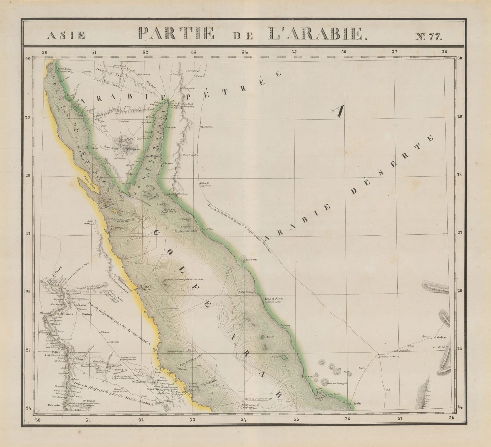
Early and detailed lithographic map of the Sinai Peninsula, Jordan, northwestern Saudi Arabia and part of Egypt, divided by the Red Sea and the Gulf of Suez. The major cities of Medina, Yanbu, .... And the village of Istabel-Antar is incorrectly marked by the coast. The religious pilgrimage/caravan route between Damascus and Mecca trails alongside the western Arabian coastline, after Johann Ludwig Buckhardt (1784-1817), a Swiss orientalist and traveller , best known for his rediscovery of the ancient city of Petra, Jordan in 1812. He was one of the first Europeans to have learnt and taken part in some of the rituals associated with the Hajj and his account was said to have been really useful for explorer and Arabist Richard Burton during his journey to Mecca in (1851-53).
The map shows a section of the River Nile, running from Qena, through the ruins of the ancient city of Thebes (near modern-day Luxor) south to Edfu and Aswan, marking the Isle de Philae, an island which houses the Temple of Isis.
A tangle of routes and soundings can be seen in the Red Sea, one of which is labelled "Route de Swallow 1776" - referring to Alexander Darymple's mapping of the Red Sea. Darymple (1737-1808) was a Scottish geographer, explorer and the very first Hydrographer to the British Admiralty.
The map marks the major landmarks, such as Mount Sinai, and
Between the coast of Egypt and the river Nile, copious annotations about the wealth of precious minerals and archaeological findings. This included the famous emerald mine of Sikait-Kubara and the Qoseyr Valley. The Sikait-Kubara mine was rediscovered in 1817 by French naturalist and mineralogist Frédéric Caillaud (1787-1869) was part of a military expedition through Egypt, Nubia and Ethiopia.
The cartographer, Philippe Vandermaelen, was born in Brussels in 1795 and, at the age of 21, inherited a fortune from his father who had been a successful soap manufacturer. Financially independent, Vandermaelen was able to devote his life to the study of geography and in 1829 he founded a geographical institute in Brussels.
Vandermaelen's most important work, entitled "Atlas Universel", was an enormous atlas consisting of over 400 separate map sheets covering the world on the huge scale of 1:1,6 million. Each map sheet was designed using a special projection so that, if the owner of the maps so wished, they could all be joined together to form a globe with a diameter of 7.75 meters (This globe was actually built in Vandermaelen's institute in Brussels). The map sheets were printed using the process of lithography, which was an early use of this printing method for map making, and were then usually delicately hand coloured to emphasise boundaries and outlines. The complete atlas took only 3 years to make, a very short time for such a large project, and it was sold in instalments over a two year period from 1825.
Examples of Vandermaelen's map sheets are of great interest to the collector for a number of reasons. Because of their large scale, they depict many of the remoter regions of the world on a scale previously unknown; the sheets covering the western parts of the United States, where exploration was still in its early stages, are unique in this respect. Their historical insets and statistics, along with their great visual clarity, make Vandermaelen's maps fascinating and valuable antique documents which also have superb visual appeal. Original hand colour.
Original hand colour. [MEAST3802] (BC)


