Philippe Vandermaelen
Java, Bali and Lombok, 1827
18 1/2 x 23 1/2 in
46.5 x 60 cm
46.5 x 60 cm
SEAS3171
Asie - Partie de l’Ile de Java. No. 27 Early lithographic map of East Java and Madura Island, east to Bali, Lombok and West Nusa Tenggara (formerly Sumbava). A...
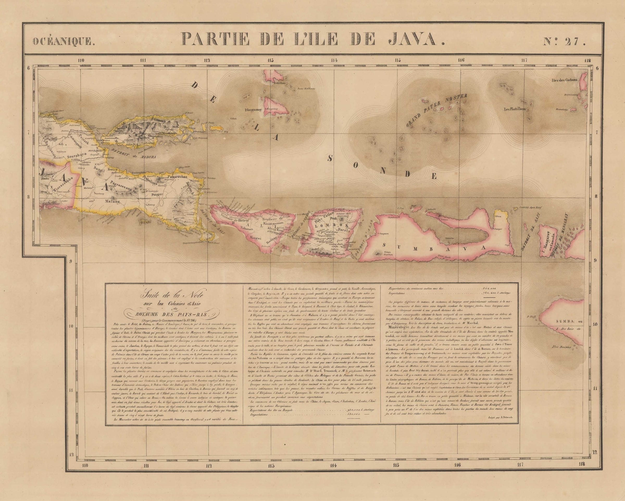
Asie - Partie de l’Ile de Java. No. 27
Early lithographic map of East Java and Madura Island, east to Bali, Lombok and West Nusa Tenggara (formerly Sumbava).
A panel of text occupies the lower centre of the map, describing the Asian colonies of the Kingdom of the Netherlands ("...Note sur les Colonies d'Asie du Royaume des Pays-Bas"). It illustrates the flora, fauna and varieties of minerals that originate and inhabit the islands and some of the valuable commodities that are sources from the island. The description also briefly touches on some of the European voyages and their discoveries.
Philippe Vandermaelen
Philippe Vandermaelen was born in Brussels in 1795 and, at the age of 21, inherited a fortune from his father who had been a successful soap manufacturer. Financially independent, Vandermaelen was able to devote his life to the study of geography and in 1829 he founded a geographical institute in Brussels.
Vandermaelen's most important work, entitled "Atlas Universel", was an enormous atlas consisting of over 400 separate map sheets covering the world on the huge scale of 1:1,6 million. Each map sheet was designed using a special projection so that, if the owner of the maps so wished, they could all be joined together to form a globe with a diameter of 7.75 meters (This globe was actually built in Vandermaelen's institute in Brussels). The map sheets were printed using the process of lithography, which was an early use of this printing method for map making, and were then usually delicately hand coloured to emphasise boundaries and outlines. The complete atlas took only 3 years to make, a very short time for such a large project, and it was sold in instalments over a two year period from 1825.
Examples of Vandermaelen's map sheets are of great interest to the collector for a number of reasons. Firstly their large scale. The sections depict many of the remoter regions of the world on a scale previously unknown or unattainable. Particularly for the collector of Americana and Australasia, the sheets covering the western United States and Pacific respectively, where exploration was still in very early stages, are unique in this respect. Their historical insets, descriptions and statistics, along with their great visual clarity, make Vandermaelen's maps fascinating and valuable antique documents which also have superb visual appeal.
Original hand colour. (SL) [SEAS3171]