Jacques-Nicolas Bellin
Portoferraio, Elba, 1764
9 ½ x 7 ½ in
24 x 19 cm
24 x 19 cm
MED2368
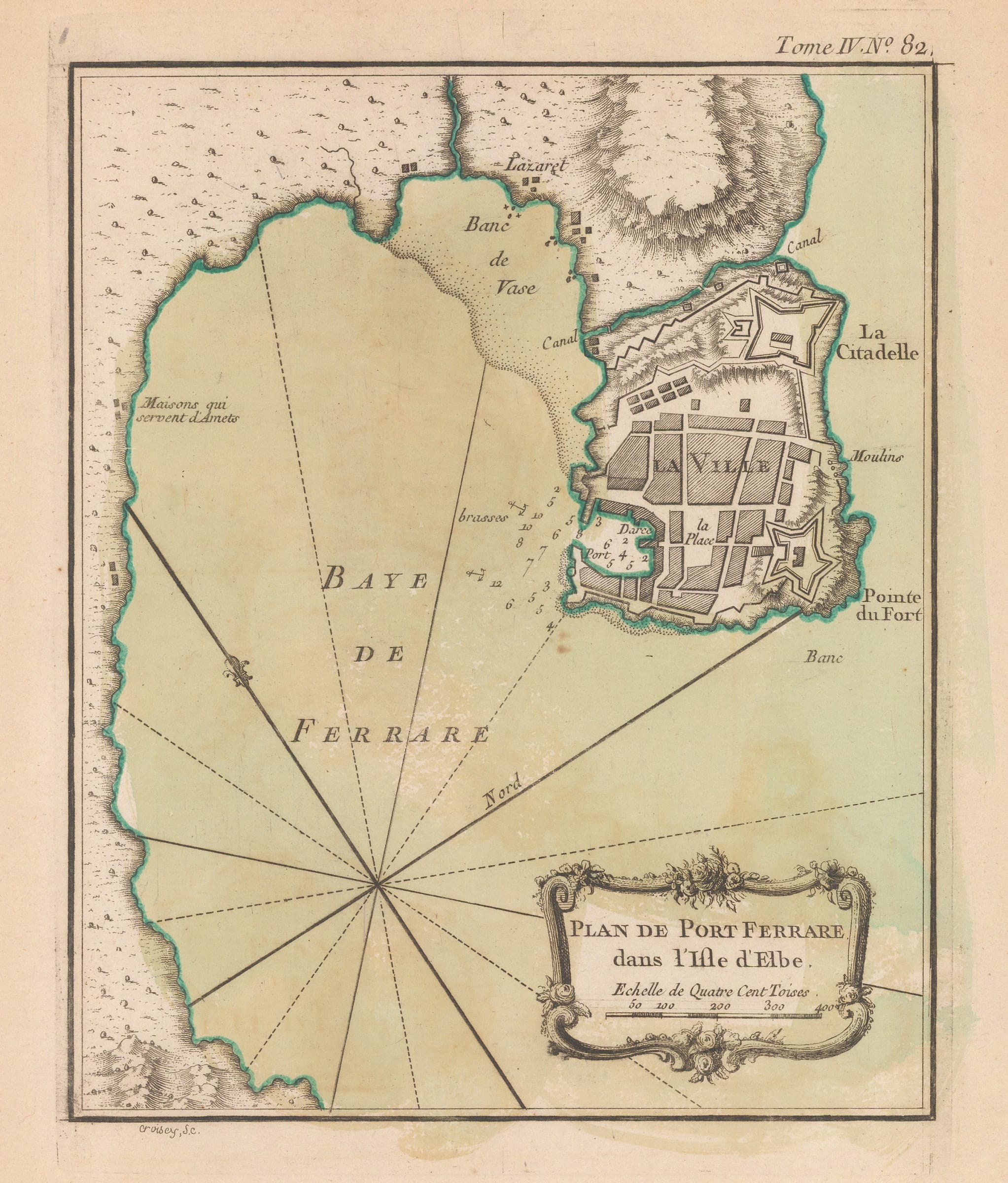
Plan de Port Ferrare dans L'Isle d'Elbe Plan of the Port de Ferrare or modern Portoferraio on the island of Elba, one of three maps of the island in...
Plan de Port Ferrare dans L'Isle d'Elbe
Plan of the Port de Ferrare or modern Portoferraio on the island of Elba, one of three maps of the island in the Petit Atlas Maritime. Oriented to show north pointing to the upper left.
Jacques-Nicolas Bellin was one of the greatest 18th century map makers. He specialised in hydrography and was appointed to the French Hydrographic office at the young age of 18 in 1721. Twenty years later he was named the first “Ingenieur de la Marine” for the “Depot des Cartes et Plans de la Marine” as well as Hydrographer to Louis XV of France. Over a fifty year career, he published a multitude of important maps often from first hand sources provided by naval officers, merchants and government sources. His level of access was extraordinary. As well as publishing his own atlases, he was a contributor to many seminal French works on exploration, including Abbee Raynal’s “Histoire des Deux Indes”, Abbee Prevost’s “Histoire Generale des Voyages” and Pierre de Charlevoix’s “Histoire et Description Generale de la Nouvelle France”.
In 1762, Bellin decided to publish one of his most popular and accessible works: “Le Petit Atlas Maritime”. The work came out in 1764 in five volumes and proved extremely popular. Many of the maps were reduced versions which Bellin had either contributed or published previously. The five volumes usually contain between 575 and 590 maps with variations noted between individual examples. As the preparation took only two years, it is very likely that Bellin had a majority of these copper plates already available. The initial financial support for the atlas was from Etienne-Francois, Duc de Choiseul, a highly placed French politician who was credited for strengthening both the army and navy. Due to its accessibility, he perceived the ”Petit Atlas Maritime” as a method of publicising both the work of the “Depot de la Marine” and the Navy to the general public. Bellin includes a long dedication to Choiseul on the front of each volume.
For collectors today, the work presents one of the widest selection of extremely desirable smaller maps. They provide clear, concise and attractive geographical records of some of the most inaccessible and exotic areas of the world in the mid-18th century. Bellin was part of a group called “Les Philosophes”, the French counterpart to the pioneers of the English Age of Reason and his maps are a lasting legacy from the Age of French Enlightenment.
This small plan of Portoferraio is one of the three maps which focus on Elba in the “Petit Atlas Maritime.” As with the others, this map first appeared in this work of 1764 and is not present in any other small maps produced by Bellin in his general voyages. Jacques Ayrouard, the “Pilot Reale” also produced a map of Bay and port although his maps was oriented differently and was less focused on the city showing more of the Bay. It may have been a basis for this map but if so, not obviously.
Original colour. [MED2368]