Willem & Jan Blaeu
Scotia Regnum, 1640 c
15 x 19 ½ in
38 x 50 cm
38 x 50 cm
SCOT1795
Particularly fine example of Blaeu’s first map of Scotland published in the Atlas Novus from 1635 onwards. The fundamental geography of this map is based on John Speed’s map of...
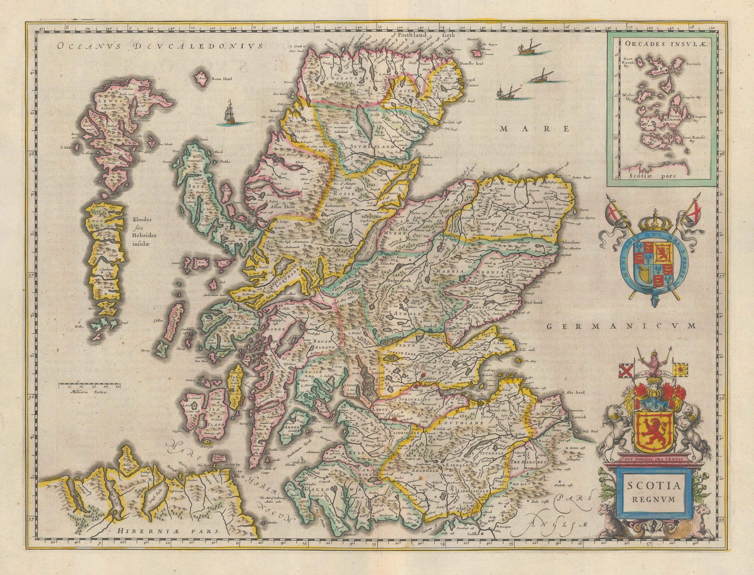
Particularly fine example of Blaeu’s first map of Scotland published in the Atlas Novus from 1635 onwards.
The fundamental geography of this map is based on John Speed’s map of 1611 who in turn based the shape of his own on map on that of Mercator’s of 1595. Speed developed his map and added further information. Furthermore, he enhanced it by adding illustrated borders of portraits of the Stuart royal family reigning in both England and Scotland at the time. Blaeu’s map matches Speed’s geographical shape and information but he omits the illustrated borders. However, Blaeu’s engraving is substantially more sophisticated and developed than that used by Jodocus Hondius (Speed’s engraver) twenty five years earlier.
This map was Blaeu’s standard map of Scotland published in his main atlas from 1635 to 1654, when Blaeu published Volume V of his Atlas Novus which was dedicated to the mapping of Scotland. Within it, he replaced this map to one drawn by the Scottish nobleman and polymath, Robert Gordon of Straloch.
Original colour. French text on reverse. Image available on request. [SCOT1795]