Willem & Jan Blaeu
France, 1650 c.
16 x 20 ½ in
40 x 52 cm
40 x 52 cm
FR3553
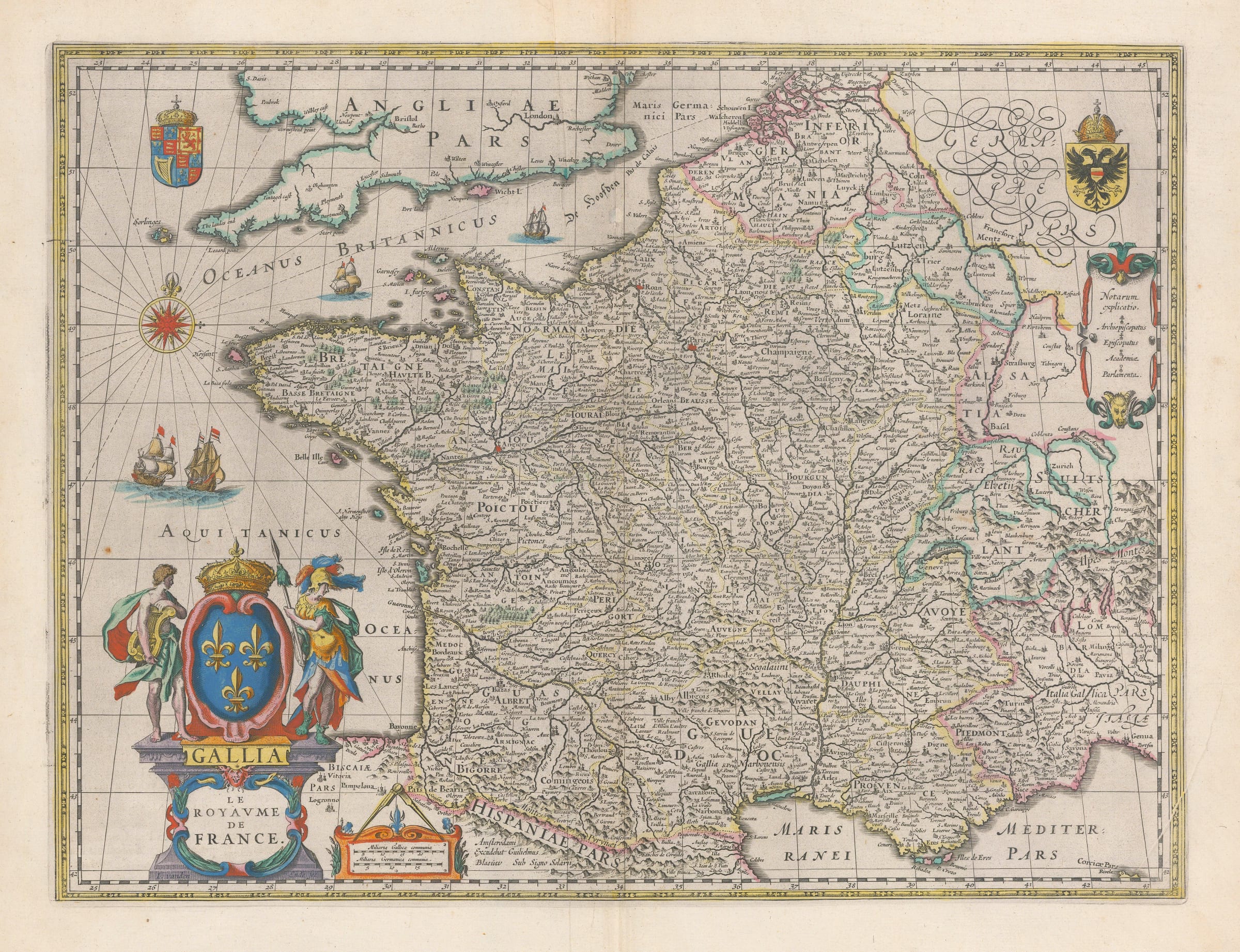
France. Embellished with ships and decorative cartouche. French text on verso. Blaeu’s map of France is an outstanding example of Golden Age Cartography. The was originally published with illustrated side...
France. Embellished with ships and decorative cartouche. French text on verso.
Blaeu’s map of France is an outstanding example of Golden Age Cartography. The was originally published with illustrated side borders in 1607 but by 1631, when Blaeu needed a map of France to add to his burgeoning atlas, this map was reduced in size by excluding the illustrated borders and added to the work.
Geographically, it is similar to the map by Mercator Hondius but both maps were published almost simultaneously. It is very likely that Blaeu used Mercator’s map as a model and then made small adjustments. Aesthetically the cartouche of the map is particularly fine, with two allegorical figures representing arts and war flanking a large depiction of the French royal coat of arms. The lower part of the pillar supporting the coat bears the name of the engraver, I. vanden Ende, one of Blaeu’s finest engravers. Blaeu discreetly adds his own name to the map under “Hispaniae” on the southern part of France.
There are also smaller coats of arms representing the Holy Roman Empire and Great Britain. This example of the map is one of the later issues with the addition of the name “Le Royaume de France” below the classical name “Gallia”.
Original colour. Latin text on reverse. Image available on request. [FR3553]