John Speed
Barkshire Described, 1616
16 x 21 in
40 x 53 cm
40 x 53 cm
BERKS377
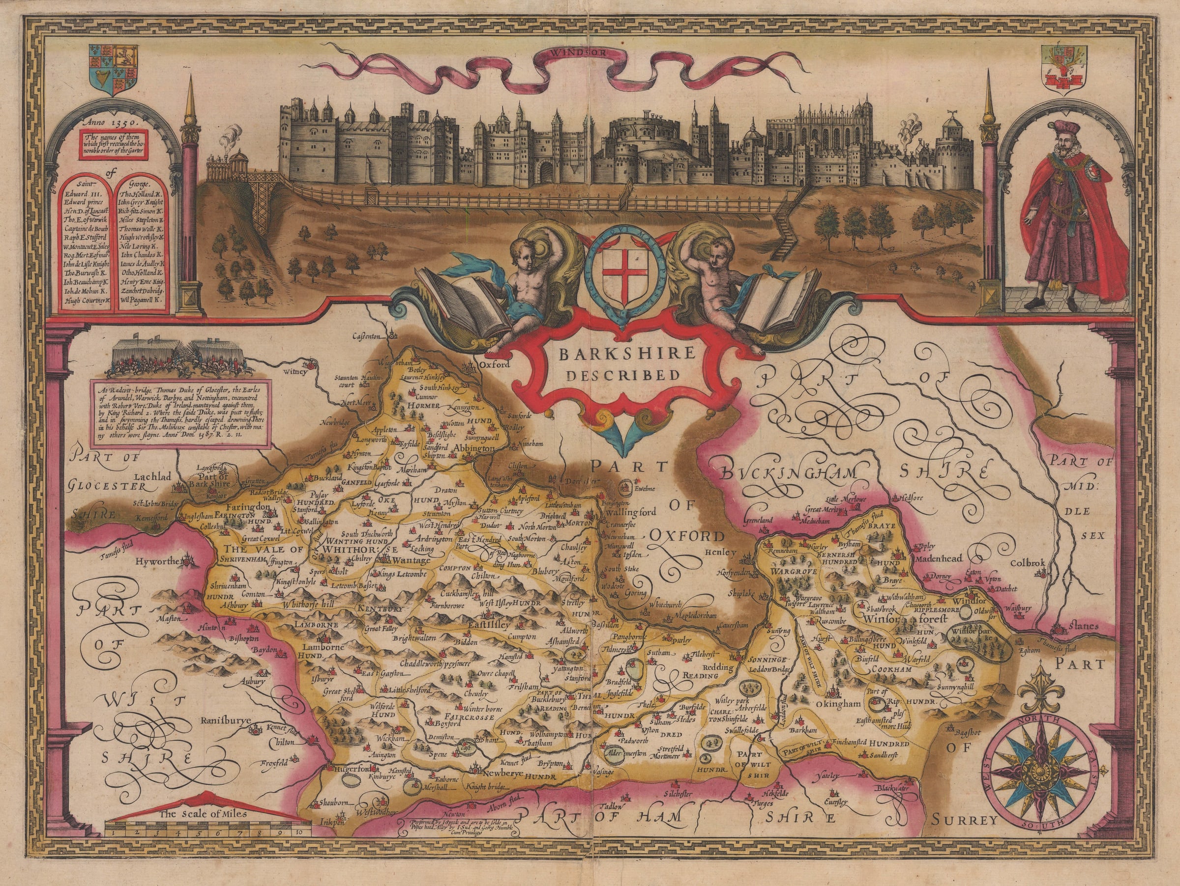
Berkshire. A fine map of the county from the rare Latin edition of Speed's seminal atlas, 'The Theatre of Great Britaine'. Grand vignette of Windsor Castle. Berkshire. A fine map...
Berkshire. A fine map of the county from the rare Latin edition of Speed's seminal atlas, 'The Theatre of Great Britaine'. Grand vignette of Windsor Castle.
Berkshire. A fine map of the county from the rare Latin edition of Speed's seminal atlas, 'The Theatre of Great Britaine'. Grand vignette of Windsor Castle.
The geographical source of the map would have been Christopher Saxton although he did not produce a singular map of Berkshire, rather he combined it with the surrounding counties of Oxford and Buckinghamshire. The first map of Berkshire as a single county was issued in William Camden’s edition of the Britannia in 1607, where it was engraved by William Hole. Speed used this model for his map, first issued in 1611.
The source for the large vignette of Windsor Castle is more problematic. There is a similar image issued by Braun and Hogenberg in the second volume of their work “Civitates Orbis Terrarum” first printed in 1575. This diagram was based on a drawing made by Georg Hofnaegel in about 1568. However, the image used by Speed is substantially more developed, reflecting several architectural additions made to the castle during the Elizabethan and early Stuart period. It was a favoured retreat for both Elizabeth I and James I, hence its prominence on this map. The source for this diagram is a mystery.
The extraordinarily rich colouring is contemporary to the publishing of the map. The descriptive text on the reverse is Latin.
Image of reverse available on request. [BERKS 377]