John Speed
Spain and Portugal, 1676
16 1/2 x 21 1/2 in
42 x 54 cm
42 x 54 cm
SP2130
Spaine Newly described with many adictions John Speed's exquisite map of Spain and Portugal embellished with miniature city views along the upper border and costumed figures on both sides....
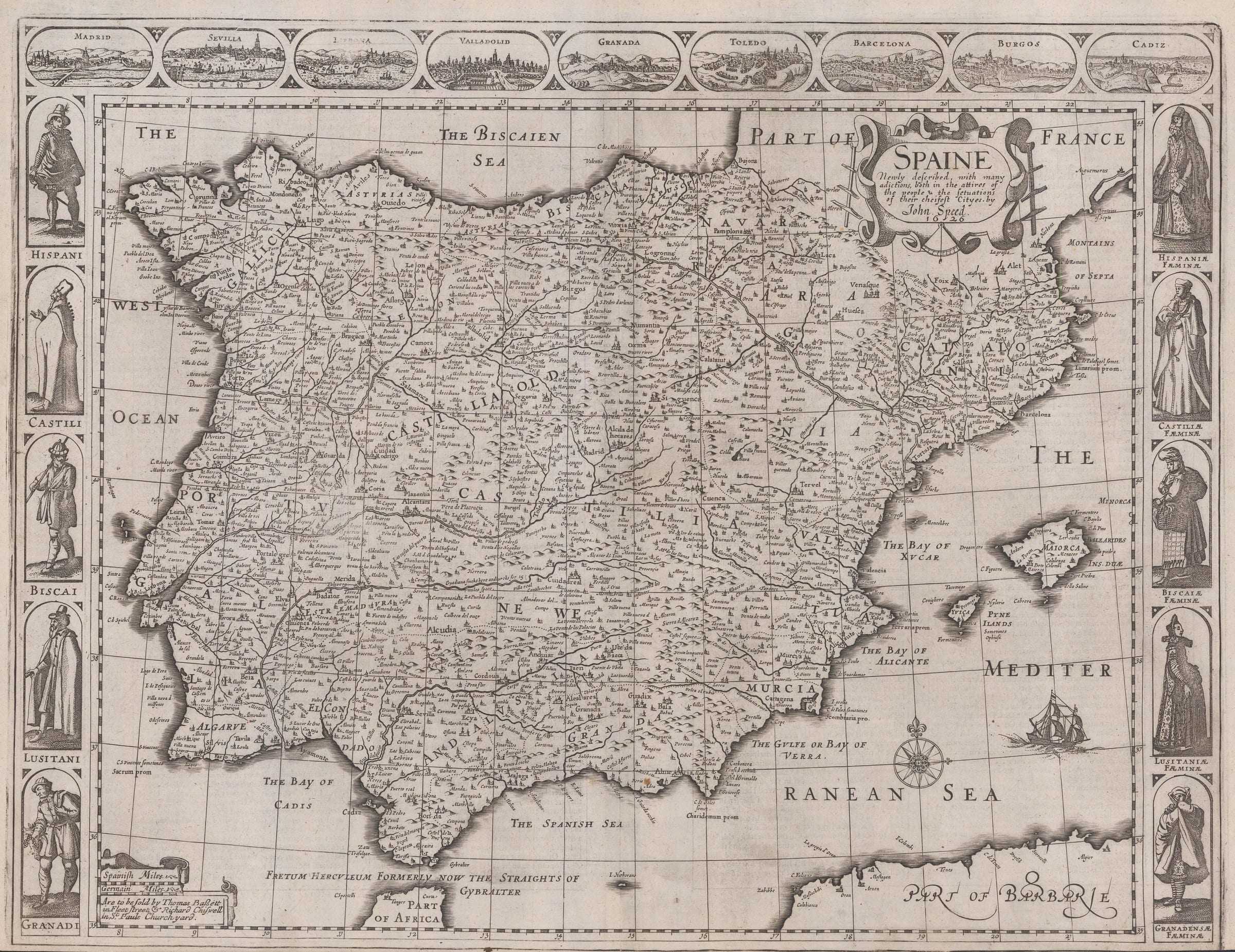
Spaine Newly described with many adictions
John Speed's exquisite map of Spain and Portugal embellished with miniature city views along the upper border and costumed figures on both sides. Madrid, Seville, Lisbon, Valladolid, Granada, Toledo, Barcelona, Burgos, and Cadiz are the cities depicted, reduced from larger views by Braun & Hogenberg. The costumed figures include men and women of Spain, Castile, Vizcaya, Portugal, and Granada.
John Speed was the most prominent and respected English map maker of the 17th century. He produced the first ever atlas of the world in English. It was attached as a supplement to his British county atlas and collectively the whole work was known as A Theater of the Empire of Great Britaine and a Prospect of the Most Famous parts of the World. This map, therefore, is the first English atlas map of Spain.
Although his atlas was intended for the English market, the maps were engraved and prepared in Amsterdam as there were no engravers with sufficient skills to do the work in England at the time. As a result, the map is heavily influenced by the Dutch style, especially with the inclusion of the sumptuous illustrated borders, generally only found on Dutch maps. The quality of the engraving is stunning, far superior to any other English maps of the period and on par with the finest Dutch Golden Age maps.
One of the most endearing characteristics of this map is the charming 17th-century description of Spain and Portugal printed on the reverse of the map in English [image available on request]. It gives a detailed overview of the history, geography, politics, and customs of Iberia, often using unintentionally humorous language.
John Speed's striking maps are highly collectible, and continue to be as appealing to collectors today as they were to Speed's contemporaries.
Basset & Chiswell (1676) edition. [SP2130]