John Speed
Penbrokshyre, 1614
15 x 20 in
38 x 51 cm
38 x 51 cm
WCTS1354
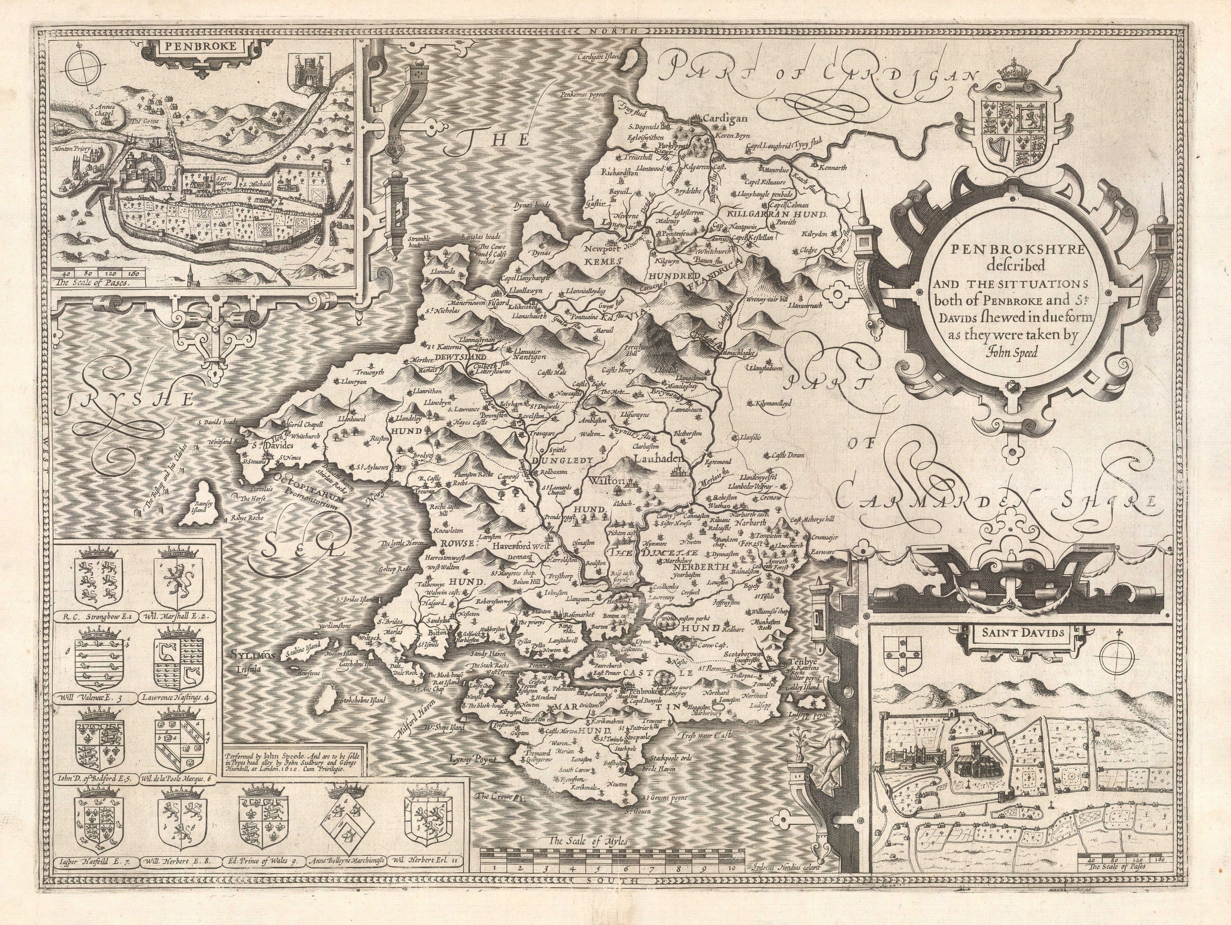
Pembroke. A fine map of the county from the second edition of Speed's seminal atlas, 'The Theatre of Great Britaine'. Vignette of Pembroke. One of the more spectacular maps of...
Pembroke. A fine map of the county from the second edition of Speed's seminal atlas, 'The Theatre of Great Britaine'. Vignette of Pembroke.
One of the more spectacular maps of the Welsh section of Speed's atlas is this map of Pembrokeshire, with its large "sugar" mountains, two insets and extensive coastline.
Geographically, it was based on Christopher Saxton's map although Speed is known to have travelled to the county to survey both the towns of Pembroke and St. David's. The former was the main population centre of the county and the latter was famous for being the supposed burial place of St. David, patron saint of Wales. Pembroke was also the birth place of Henry VII, founder of the Tudor dynasty, so it was certainly important enough to warrant a visit by Speed.
Pembrokeshire is one of the few maps on which Speed places two city plans, Pembroke and St. David's as mentioned above. He also places a series of heraldic shields on the lower left corner mainly on the sea, which leaves little room for his characteristic galleons and sea monsters. He does add one curious feature in the sea on the left centre of the map: a set of rocks named "The Bishop and his Clerkes" which today are known as the Bishop and Clerk Islands, a series of small reefs, rocks and islets which were notoriously dangerous to mariners.
English text on verso. Image available on request.
[WCTS1354]