John Speed
The Kingdome of Great Britaine and Ireland, 1614
15 x 20 in
38 x 51 cm
38 x 51 cm
GB1790
This is the first map appearing in John Speed's masterpiece, 'The Theater of the Empire of Great Britain' and serves as an introduction to the reader, illustrating the full extent...
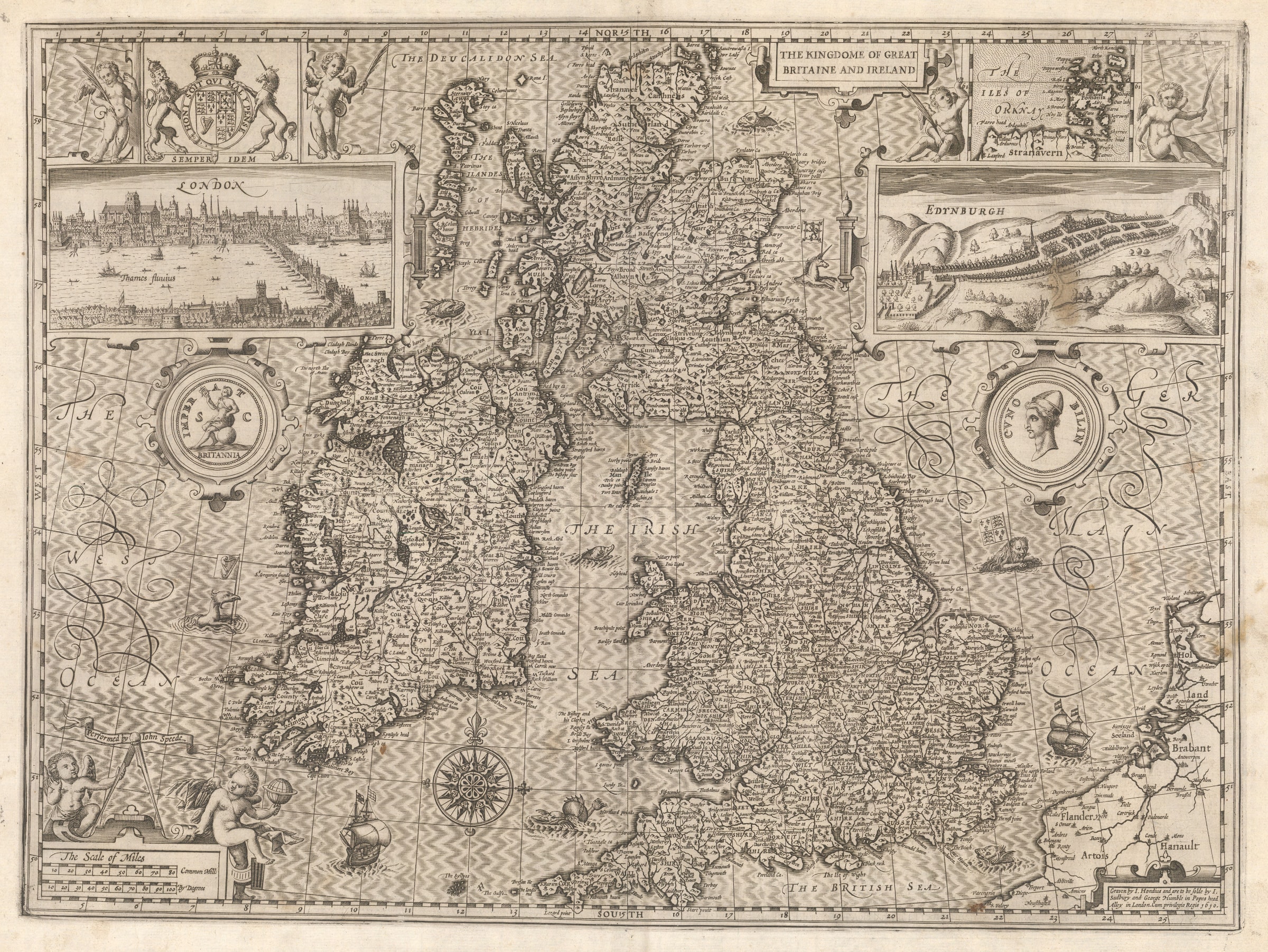
This is the first map appearing in John Speed's masterpiece, "The Theater of the Empire of Great Britain" and serves as an introduction to the reader, illustrating the full extent of the survey portrayed in the work.
It shows all the kingdoms under the rule of James I of England and VI of Scotland, a point which is emphasized by the inclusion of small vignettes of the cities of London and Edinburgh, on the left and right of the map respectively. As well as England and Wales, Scotland and Ireland are also included on this map, now part of this new political construct.
Unusually, Speed does not include his name on this map although the lower right corner bears a small panel crediting the engraving to Jodocus Hondius, often cited as the greatest engraver of his generation, together with John Sudbury and George Humble, Speed's publishers and main commercial agents.
The Dutch influence is further illustrated by the beauty of the map, including the "silk" pattern on the sea, the myriad of ships and sea monsters as well as the two medallions on the left and right, portraying Britannia and Cunobellinus, a legendary king of pre-Roman Britain.
Finally, the royal coat of arms is prominently displayed on the upper left corner, just above London and a small inset on the upper right shows the Orkney Islands.
This is one of the most beautiful and iconic maps of Great Britain published in in the early 17th century and a fitting testament to Speed's enduring fame as the greatest British map maker of his age.
Strong impression. English text on verso. Image available on request.
[GB1790]