Aaron Arrowsmith
Very rare wall map of the United States, 1822 c.
48 x 55 ½ in
122 x 141 cm
Each sheet: 61 x 141 cm
122 x 141 cm
Each sheet: 61 x 141 cm
USA8507
A Map of the United States of North America This fundamental piece illustrating American cartographic history, though already incredibly rare, is made even more so by the later manuscript...
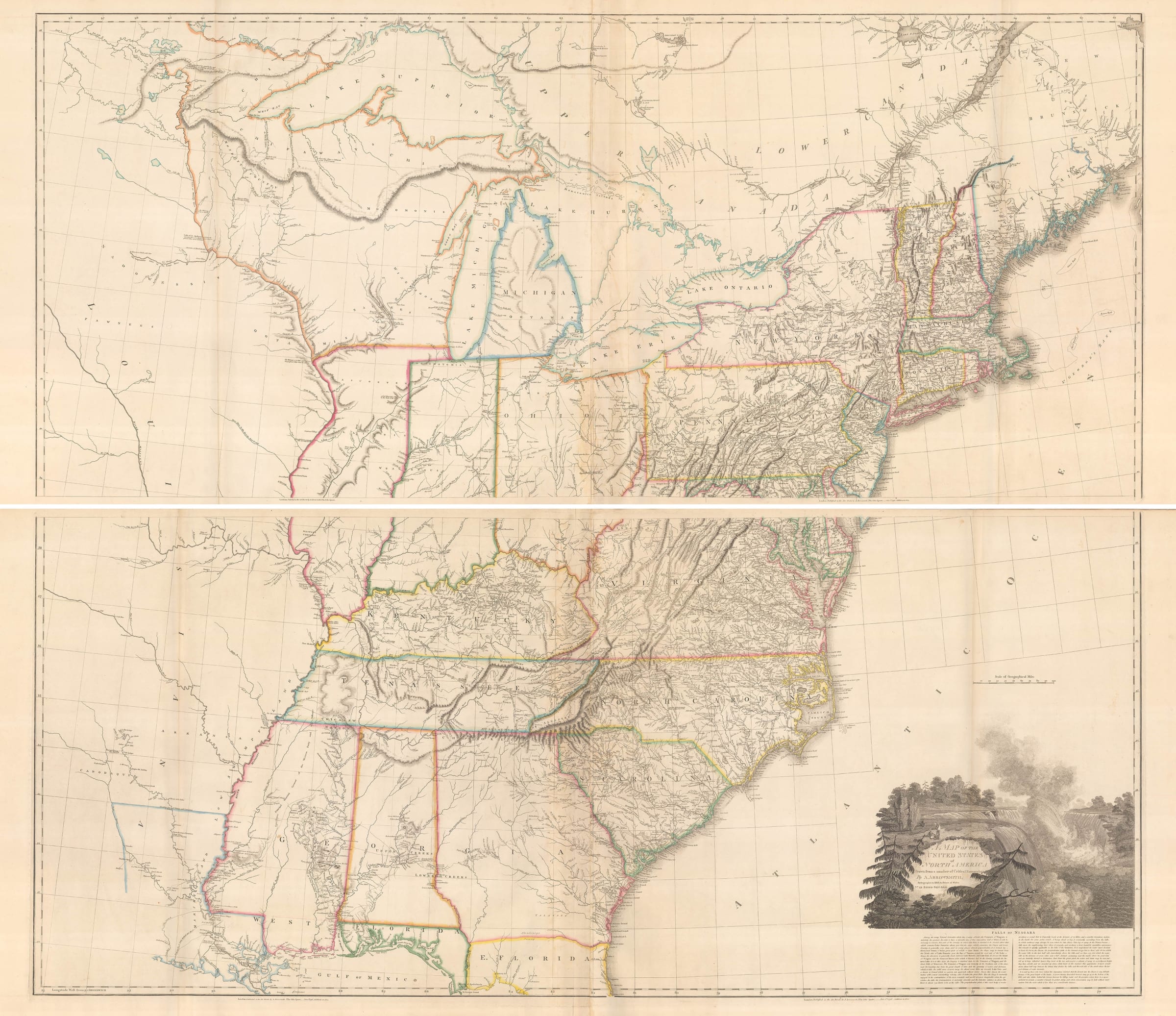
A Map of the United States of North America
This fundamental piece illustrating American cartographic history, though already incredibly rare, is made even more so by the later manuscript and colour embellishments. First printed in 1796 and reprinted with additions in 1802, the geography of the map has been subsequently and professionaly amended to show new developments in the geography of the United States.
The immense state of Georgia has now been divided to include the boundaries of the newly created states of Alabama and Mississippi, which both joined the union in 1817. Additions have also been made to the mid-west, incorporating the borders of Illinois, Indiana and Ohio.
Of particular interest is the depiction of the border between Illinois and Indiana. The Illinois Territory was first created in 1809 and its proposed northern boundary was rapidly moved twice. The Illinois legislator, Nathaniel Pope, was encouraged by the effective northern extension of Indiana to reach the shoreline of Lake Michigan. Lobbying fiercely in Washington, Pope also succeeded in shifting the border of Illinois further north. In 1818 he gained nearly 50 miles of the Lake Michigan shoreline and the Chicago River for the state. It is this second border change which is illustrated on our map. It is most likely that these changes were either commissioned by the owner of the map, or added for commercial purposes by the publishing house.
These later additions on this fundamental map capture a very exciting moment in the history of the nascent United States.
[USA8507]