Abraham Ortelius
Ortelius's Rare 2-Sheet Map of Britain, 1590
28 ½ x 19 ½ in
73 x 49 cm
73 x 49 cm
GB1965
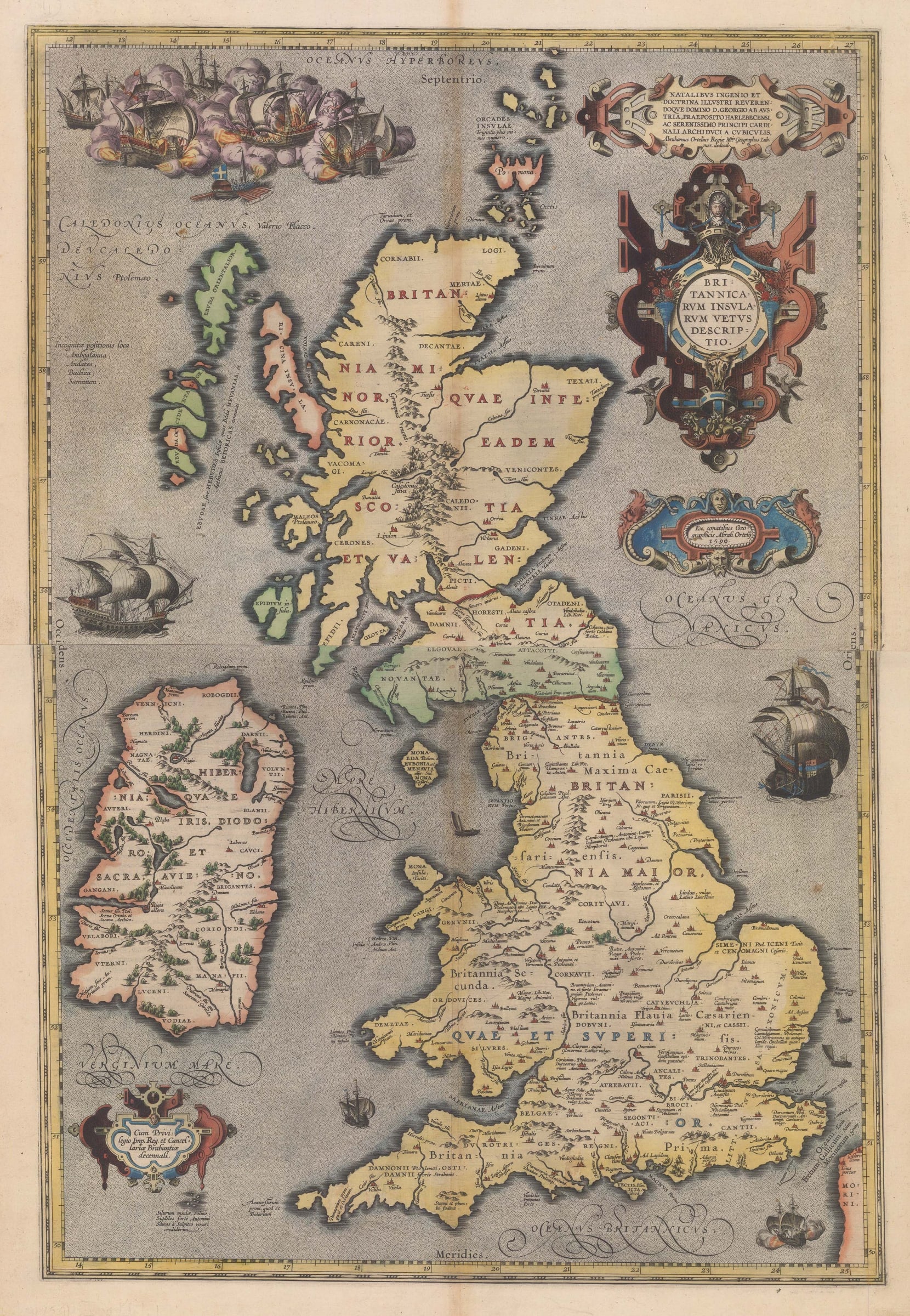
Britannicarum Insularum Vetus Descriptio Rare two-sheet map of ancient Great Britain and Ireland decorated with strapwork cartouches and a naval battle scene, the most elaborate on any of Ortelius's...
Britannicarum Insularum Vetus Descriptio
Rare two-sheet map of ancient Great Britain and Ireland decorated with strapwork cartouches and a naval battle scene, the most elaborate on any of Ortelius's maps. Unusually, Ortelius credits his own geographical studies for the creation of this map rather than a contemporary scholar. Though as Ortelius was an avid historian with a particular interest in the writings of the Roman period, this is quite understandable. Latin text on the verso provides a history of ancient Britain and Ireland according to classical authors.
This specific map was only published in the 1590, 1591, and 1592 editions of Ortelius's "Theatrum Orbis Terrarum", the first modern world atlas, though a handful of 'leftover' copies have been found in the 1602 edition as well. Fewer than 750 copies of this map were thought to have been published. It was replaced in the 1595 edition by the more common, smaller, single-sheet map.
Latin text on verso (image available on request). Fine original hand-colour. [GB1965]