Abraham Ortelius
One of the cornerstone maps of Africa, 1595 c.
15 1/2 x 20 1/2 in
39 x 52 cm
39 x 52 cm
AFR5220
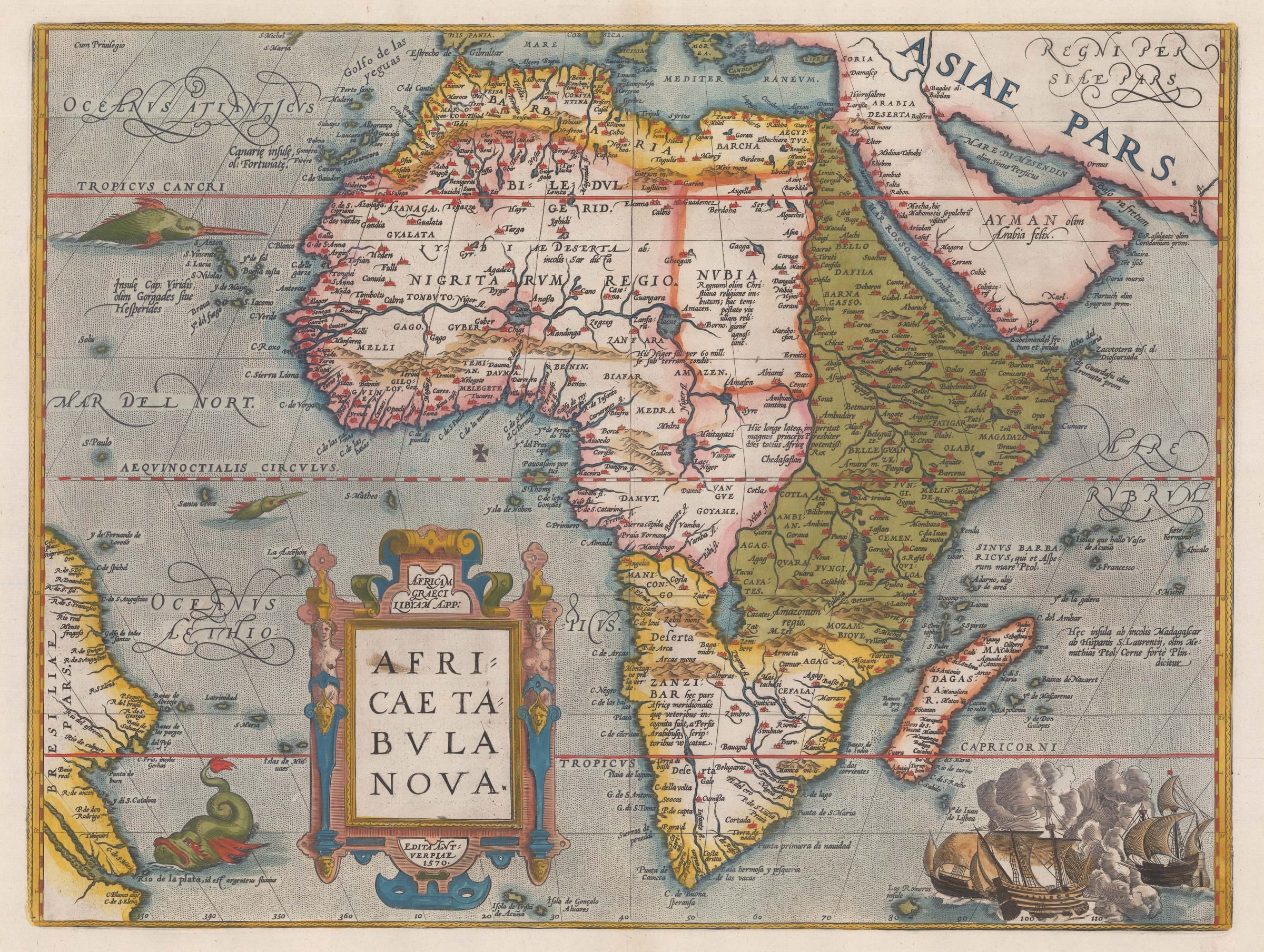
Africae Tabula Nova One of the cornerstone maps of the African continent. It remained the standard map of Africa well into the seventeenth century. Ortelius introduced two important changes...
Africae Tabula Nova
One of the cornerstone maps of the African continent. It remained the standard map of Africa well into the seventeenth century. Ortelius introduced two important changes to the shape of the continent: the Cape of Good Hope became more pointed and the eastward extension of the continent was significantly reduced. Splendidly decorated with ships, sea monsters, and a large strapwork title cartouche.
Latin text on verso (image available on request). Coloured.
[Marcel van den Broecke "Ortelius Atlas Maps, An Illustrated Guide" 2nd Edition: Ort 8]
[Betz (R.L.): "The Mapping of Africa": 12.5] [AFR5220]