Abraham Ortelius
Electorate of Brandenburg, 1592
14 x 19 ½ in
36 x 50 cm
36 x 50 cm
GER2237
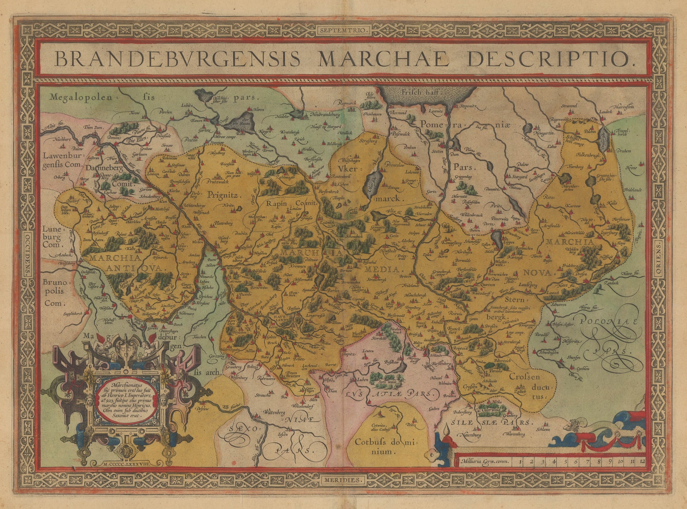
Brandeburgensis Marchae Descriptio Stunning early map showing the territory controlled by the Electorate of Brandenburg at the end of the 16th century. Berlin is located at the centre of...
Brandeburgensis Marchae Descriptio
Stunning early map showing the territory controlled by the Electorate of Brandenburg at the end of the 16th century. Berlin is located at the centre of the map. Elaborate strapwork cartouche and border.
Original hand-colour. French text on verso (image available on request).
[GER2237]
Stunning early map showing the territory controlled by the Electorate of Brandenburg at the end of the 16th century. Berlin is located at the centre of the map. Elaborate strapwork cartouche and border.
Original hand-colour. French text on verso (image available on request).
[GER2237]