Georg Braun & Frans Hogenberg
Paris, 1572
13 x 19 ½ in
33 x 49 cm
33 x 49 cm
FR3431
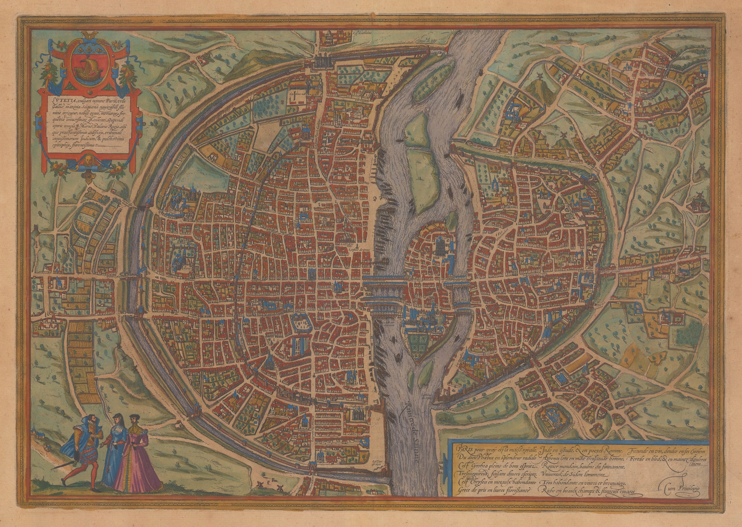
Lutetia vulgari nomine Paris Braun and Hogenberg's plan of Paris, probably the best known 16th century view of the city. As with all 16th century plans of the city,...
Lutetia vulgari nomine Paris
Braun and Hogenberg's plan of Paris, probably the best known 16th century view of the city.
As with all 16th century plans of the city, the source for this map is the "Premier Plan", the now lost wall map prepared between 1523-30. This map was supposed to have measured 5 by 4 meters. The map was prepared during the reign of Francis I of France, who was a great supporter of the arts and sciences, emulating the support of the Italian monarchs who sponsored the Renaissance. However, it is unknown if he was involved in the production of the Premier Plan.
With this provenance, this plan now shows the city approximately forty years out of date. It is oriented showing north to the left and focuses mainly on the city within its defensive walls, although some of the settlements outside are beginning to make an appearance.
This version of the Premier Plan is generally acknowledged to be the most striking and visually attractive of the later issues available from the 16th century.
Coloured.